
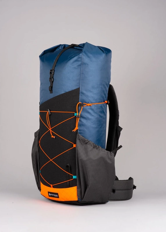
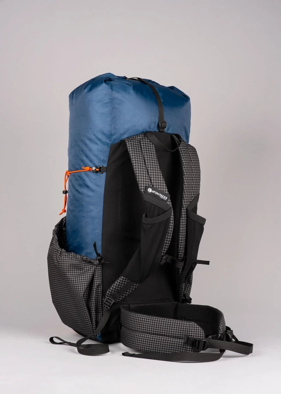
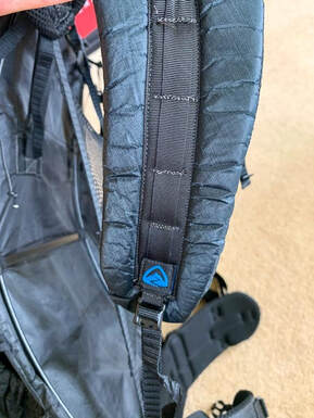
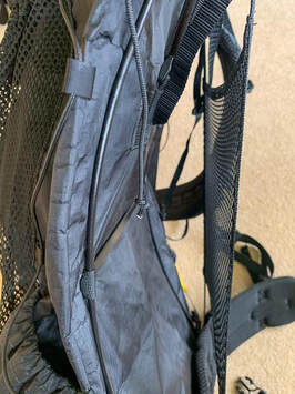
These packs are made to order and you can choose from a variety of bespoke colours, features and sizes to ensure that nobody else will have a pack like yours. If you like ‘em bright you can do this but those who prefer muted colours are catered for too. You can pack the bags with features or you can further lighten them by paring down the external pockets and features. 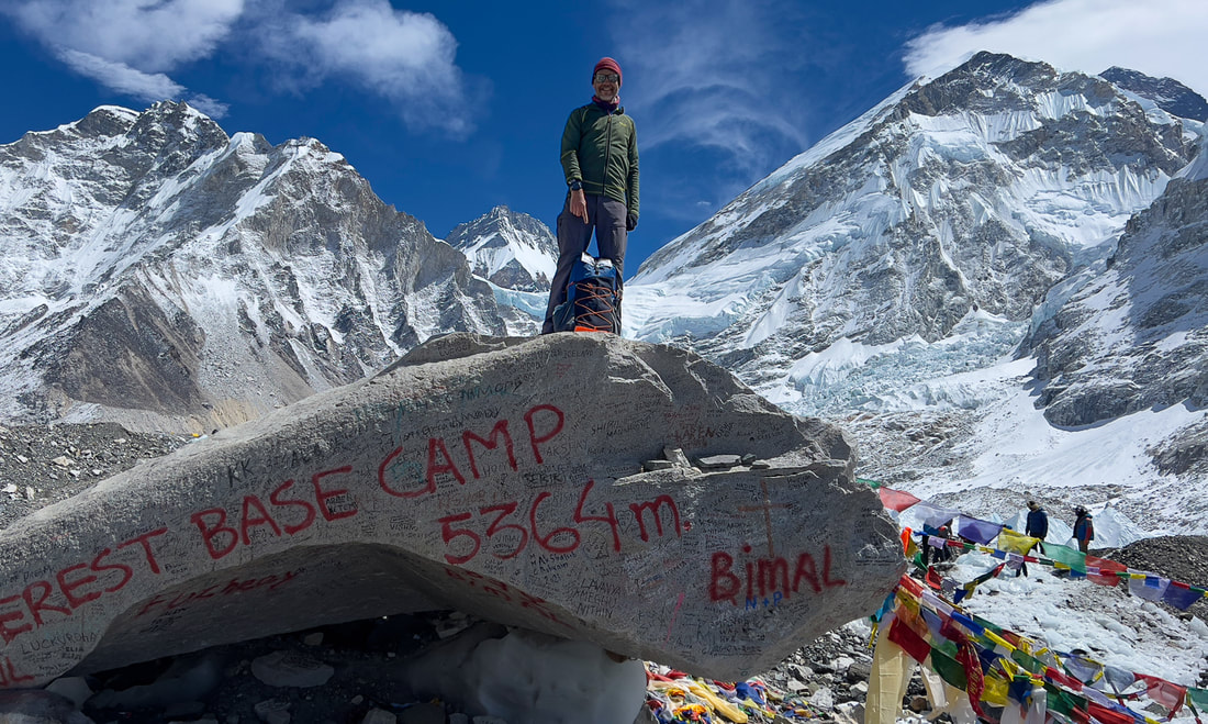 First Impressions When you take it out of the wrapping, the colours of the pack immediately jump out at you. Unless you have ordered muted shades, you will not have seen anything else like it. My pack was the default factory design which is lovely: a classy muted blue married with brightly contrasting orange trimming and chequered grey side-pockets. The next thing you notice is the weight. It feels astonishingly light: barely anything there when you lift it in its empty state. And yet the material feels substantial and strong: much more substantial than the thinner materials used for some other light-weight packs. The main body is made of EPX200 with a DWR finish: it is very light, highly waterproof and feels great. Time will tell but I think that it will last a long time. The straps and buckles are light but well designed and sufficiently padded for most people, I think. The frame is a very interesting design: a carbon hoop fits into the back panel which you can remove if you want (for a 55g weight saving). I used to worry a lot about these carbon frames but over the years, I have never broken one so I am more relaxed now. This one even seems better protected than many by being shielded within the back panel. My pack (two side pockets, medium torso and medium hip belt) weighed in at a mere 656g (23.2 oz): less than half the weight of some light-weight offerings by larger manufacturers. Fitting Because there are so many sizing options to choose from, if you measure yourself accurately, the pack should fit perfectly. Mine certainly did. Definitely one of the most comfortable packs when loaded that I have ever used. It feels snug, secure and comfortable. Some might question the lack of straps at the shoulders but I found that I did not need them: presumably this is one of the benefits of bespoke sizing. Nor can you adjust the height of the straps but you should not need to if you have measured correctly. Remember that these are bespoke packs made specifically for you. Testing
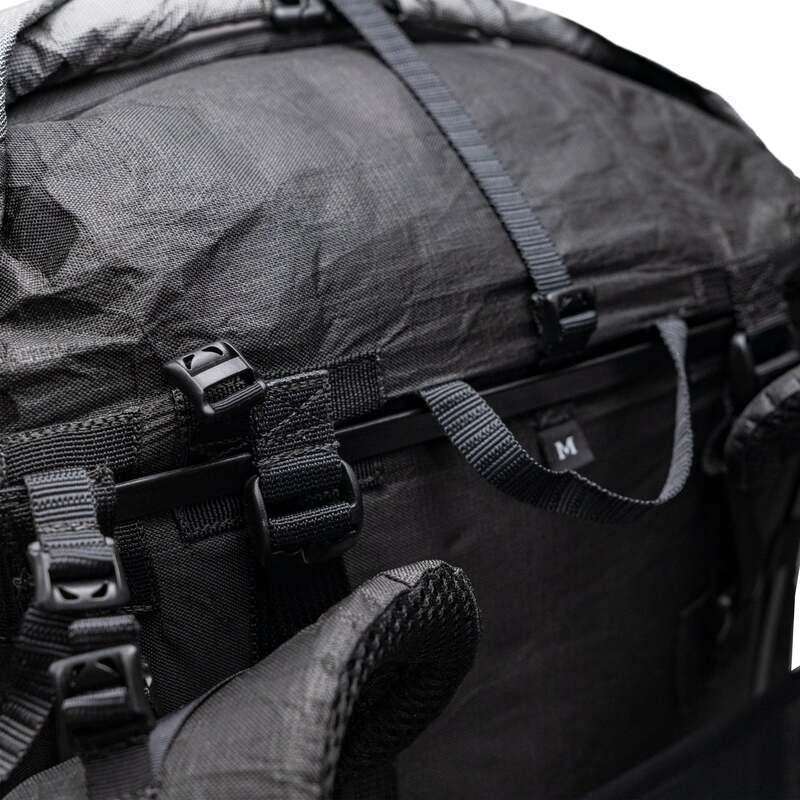
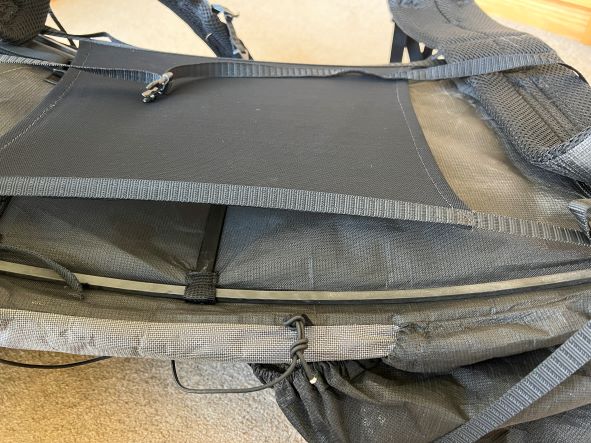
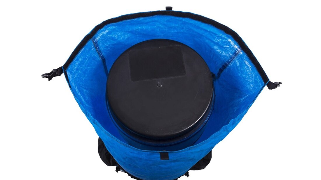
Features I loved the huge, stretchy Dyneema pocket at the front of the pack: I used it for my rain jacket. It seemed very durable, something that can be an issue with other packs. Roll-top closure: European trekkers will take a while to get used to the roll-top closure which is quite unlike traditional packs. However, I have to say that I am a complete convert. It saves weight and is very waterproof. You may miss having a pocket on top but this is easily remedied by adding one or two belt pouches. Side pockets: there are two and they are well-designed, making it easy to reach for a water bottle or other items. They fit Nalgene bottles and the height of them is good, making it easy to access bottles while wearing the pack. If you wish, you can have the pack made without these to save weight. Bottom pocket: the stretchy ‘trash port’ at the bottom of the pack is an excellent innovation. It keeps your trash away from the rest of your kit. We loved it! Shoulder pockets: these are well-designed being bigger than those on many other packs. Customisation Atom Pack’s website has an excellent custom pack builder which leads you seamlessly through the process and there are an incredible number of variables:
Conclusion
Trekking Map: Iceland's Laugavegur Trail (& Fimmvörðuháls Trail)
£16.99
Available Now! Waterproof sheet map for Iceland's Laugavegur Trail (& Fimmvörðuháls Trail): 1:40,000. Includes free GPX downloads for the trails. The definitive map to Iceland’s two best trails: larger scale and more detail than any other map. Made specifically for the treks by Knife Edge Outdoor Guidebooks.
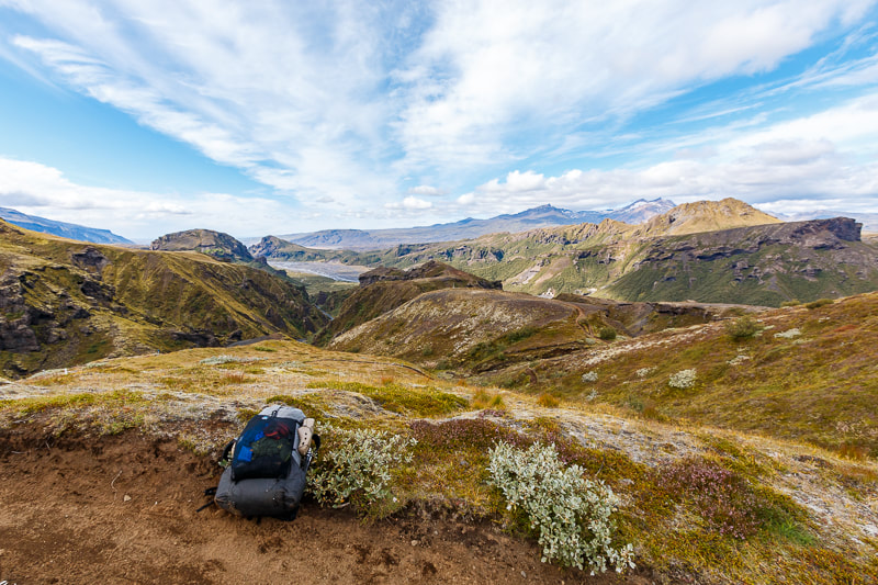
The Laugavegur Trail is one of the world's most beautiful and aspirational treks. It leads you into the heart of Iceland’s unique ice-capped, volcanic terrain. Experience spectacular and unusual landscapes, the likes of which you will not find anywhere else on the planet. Impressive volcanic peaks are a constant companion and steam gushes from the ground. This is Iceland at its best and it will be an adventure that you will never forget Tour of Monte Rosa: Trekking Map
£16.99
Available now! The best sheet map for the Tour of Monte Rosa. Displays the entire route and variants on a single sheet: perfect for planning and navigation. 1:40,000 - larger scale and more detail than any other map. Made specifically for the Tour of Monte Rosa by Knife Edge Outdoor Guidebooks:
The Tour of Monte Rosa is one of the classic Alpine treks. It leads the trekker on an epic circuit around the Monte Rosa massif. The largest group of 4000m peaks in the Alps is on display: the Weisshorn, the Zinalrothorn, the Dom, the Täschhorn, the Breithorn and the Matterhorn, to name a few. It is the sister trek to the Walker’s Haute Route and crosses unspoilt and remote mountain terrain: amazing glaciers, snow frosted summits, beautiful valleys and pastures, shimmering lakes, carpets of wild flowers and the soothing sound of cow bells. This trek should be on your hiking bucket list Tour des Combins: Trekking Map
£16.99
Available now! The best sheet map for the Tour des Combins. Displays the entire route and variants on a single sheet: perfect for planning and navigation. 1:40,000 - larger scale and more detail than any other map. Made specifically for the Tour des Combins by Knife Edge Outdoor Guidebooks:
The Tour des Combins is an epic trek in the Swiss and Italian Alps. It traverses some of Europe's wildest mountain terrain. The sublime scenery makes it a worthy alternative to the more famous Tour du Mont Blanc (which is only a stone's throw away). Hike along the edge of the Corbassière Glacier, one of the longest in Europe. Enjoy snow frosted summits, magnificent valleys and pastures, sparkling azure lakes, carpets of wild flowers, the soothing sound of cow bells and easy to follow paths. Stay in spectacularly situated villages and remote mountain huts. This will be a trip that you will never forget Everest Base Camp: Trekking Map (includes Classic EBC, Three Passes & Gokyo Lakes)
£16.99
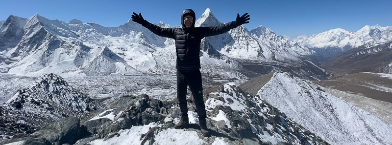
Available now! The best sheet map for the Everest treks: Classic EBC, Three Passes & Gokyo Lakes (all clearly colour coded). 1:40,000 - larger scale and more detail than any other Everest map. Perfect for planning and navigation. Includes walk-in route to Lukla Made specifically for the Everest treks by Knife Edge Outdoor Guidebooks:
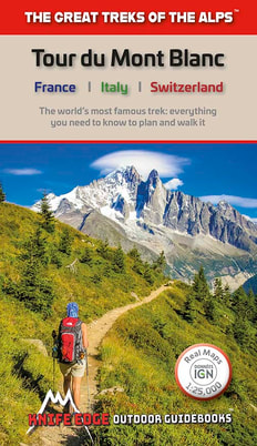
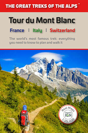
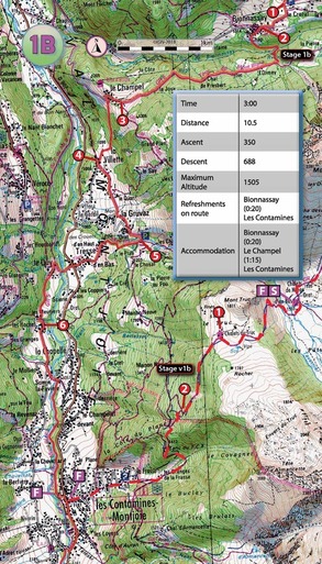
Tour du Mont Blanc (2022 updated version)
£16.99
AVAILABLE NOW!
Complete guidebook for planning and trekking the Tour du Mont Blanc, the world's most famous trek Real maps for each stage: 1:25,000. No need to carry a separate map! Unique Itinerary Planner: plan a bespoke itinerary to match your ability and vacation schedule. All difficult calculations of time, distance and altitude gain are done for you Everything the trekker needs to know: route descriptions, costs, budget, difficulty, weather, how to get there, and more Full accommodation listings: spectacularly situated mountain huts, villages and hamlets Full section on camping: a complete list of camping locations 10 exciting variants to the main route! Information for both self-guided and guided trekkers Trekking the West Highland Way: Two-way guide
£16.99
Available Now! The definitive two-way guide to the West Highland Way: both northbound and southbound routes are described in full. Real Maps: Full Ordnance Survey Explorer mapping inside (1:25,000) 17 different itineraries: schedules of 3, 4, 5, 6, 7, 8, 9, 10 and 11 days for hikers and runners. Includes both southbound and northbound itineraries. Difficult calculations of time, distance and altitude gain are done for you. Also includes:
Trekking Map: Walker’s Haute Route: Chamonix to Zermatt: 1:40,000 mapping; Free GPX downloads
£16.99
Available Now
The best sheet map for the Walker’s Haute Route: Chamonix to Zermatt. This is the only map available that displays the entire route and numerous variants on a single sheet: perfect for planning and navigation. 1:40,000: larger scale and more detail than any other map. 1:10,000: for select areas where navigation is challenging. Made specifically for the Walker’s Haute Route by Knife Edge Outdoor Guidebooks:
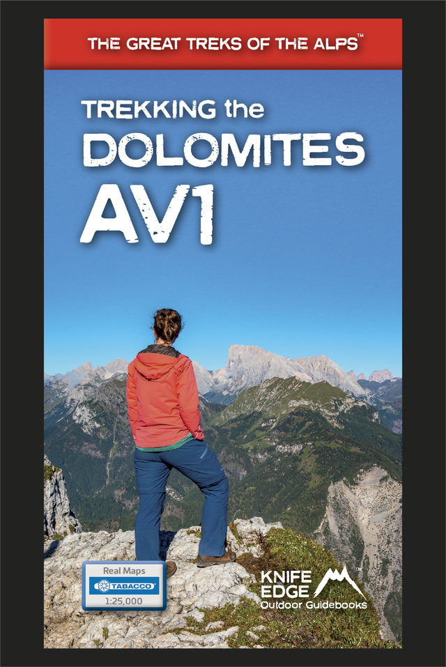
Trekking the Dolomites AV1 (2024 updated version)
£16.99
Fully Updated for 2024! The only guidebook exclusively for the AV1. Real maps inside (Tabacco 1:25,000): the finest maps available for the Dolomites. Everything you need to know to plan and walk Italy's most popular long distance route. Also includes: Numbered waypoints linking maps to text Unique Itinerary Planner: plan a bespoke itinerary to match your ability and vacation schedule. All difficult calculations of time, distance and altitude gain are done for you 7 Proposed Itineraries of between 6 and 11 days Everything the trekker needs to know to plan the route: route descriptions, costs, budget, difficulty, weather, how to get there, and more Full accommodation listings: spectacularly situated mountain huts Section on Camping Exciting variants to the main route Information for both self-guided and guided trekkers Edge to edge colour: the most modern and beautiful guidebooks Trekking the Corsica GR20
£15.99
Available now! The only two-way guide to the GR20: both northbound and southbound routes are described in full. Real IGN Maps included (1:25,000): no need to carry separate maps. 15 different itineraries: schedules of 9, 10, 11, 12, 13, 14, 15 and 16 days. Includes both northbound and southbound itineraries. Difficult calculations of time, distance and altitude gain are done for you. Also includes:
Trekking Iceland's Laugavegur Trail (& Fimmvörðuháls Trail)
£17.99
Available Now! The definitive two-way guide to Iceland's Laugavegur Trail (& Fimmvörðuháls Trail): both southbound and northbound routes are described in full. Real Maps: full mapping inside (1:40,000), made specifically for the treks by Knife Edge Outdoor Guidebooks. All accommodation/campsites are numbered and marked on the maps. 14 different itineraries: schedules of 2, 3, 4, 5, 6 and 7 days for hikers and runners. Includes both southbound and northbound itineraries. Difficult calculations of time, distance and altitude gain/loss are done for you. Also includes:
Trekking the Mallorca GR221
£16.99
Available Now! The definitive two-way guide to the Mallorca GR221 (the Drystone Way): both northbound and southbound routes are described in full. Real Maps: Full mapping inside (1:25,000) by Editorial Alpina. All accommodation is numbered and marked on the maps. 12 different itineraries: schedules of 7, 8, 9, 10 and 11 days for hikers and runners. Includes both northbound and southbound itineraries. Difficult calculations of time, distance and altitude gain/loss are done for you. Also includes:
Trekking the Hadrian’s Wall Path (2024 Updated Version)
£16.99
Available now! Real OS maps 1:25,000 The definitive two-way guide to the Hadrian’s Wall Path: both eastbound and westbound routes are described in full. 14 different itineraries: schedules of 3, 4, 5, 6, 7, 8 and 9 days for walkers and runners. Includes both northbound and southbound itineraries. Difficult calculations of time, distance and altitude gain are done for you. Also includes:
Hadrian’s Wall was one of the Romans’ most ambitious structures. When completed, it ran for 73 miles between the west and east coasts of Northern England. It crossed the crags and hills of some of Britain’s wildest and most beautiful terrain. The Hadrian’s Wall path is one of England’s official ‘National Trails’. It leads you on an unforgettable journey of discovery along the route of the Wall. Discover the incredible surviving sections of the Wall and its forts, milecastles and turrets.
0 Comments
As an outdoor writer and photographer, I spend a lot of time on the trail. Long days with a fully-laden pack is part of my job so I am constantly looking for products which help me lighten the load, without a reduction in performance. Often one of the heaviest things a backpacker carries is the backpack itself and the differences in weights between products can be large. The very lightest packs are light because they incorporate the lightest products available and these are pared down to the bare minimum. Very light materials tend to be very thin. And very thin material is often not very durable.
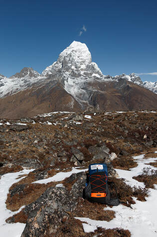
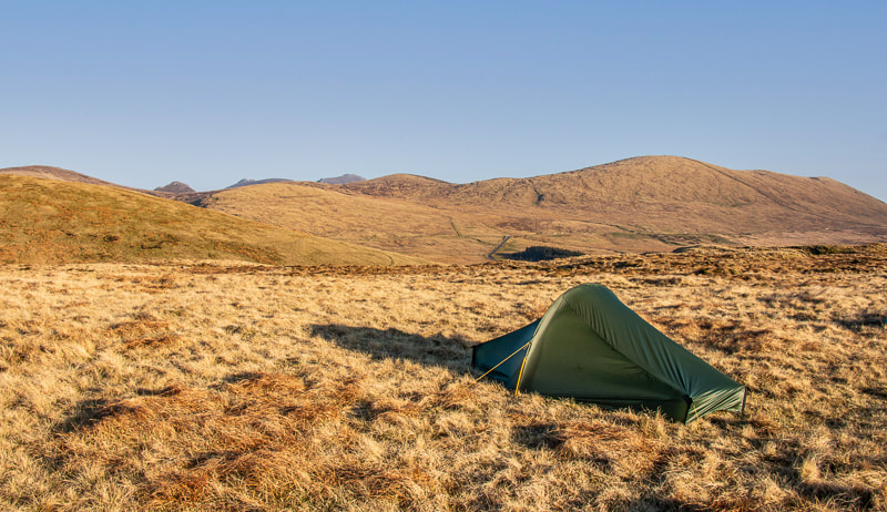
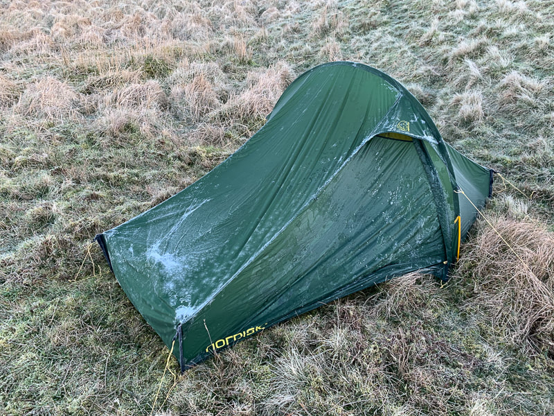
 Zpacks Arc Haul Ultra 60L on the trail in Iceland First Impressions
FittingI found that fitting the Arc Haul was easier than fitting the Arc Blast because the frame has been pre-tensioned. There is a good video on Zpacks’ website which clearly shows you how to adjust the straps, etc. Once fitted properly, the pack feels snug, secure and comfortable. There are few manufacturers which give such good guidance on fitting. I am 183cm tall and I chose the medium size: apparently almost nobody goes for the large. It fitted me well but only just. I think that anybody slightly taller than me might find the medium to be too small. One minor observation: I have both the Arc Haul and Arc Blast in the same sizes and I found the Arc Haul to be ever so slightly smaller than the Arc Blast. With the Arc Haul, I was at the very limits of the size band but with the Arc Blast I had a tiny margin to play with. Testing
Water-proofing: I tested the pack over 17 days in the wettest part of a very wet country and I found that the Ultra 200 material is very waterproof. I noticed no difference in this regard from the Arc Blast which also performs amazingly. There are a few places where a small amount of water does get in but this is a minor gripe as the pack scores far better than its competitors in this regard. I would still carry a dry-bag though on longer trips but that is no issue as good ones weigh a mere 20g. Features
Roll-top closure: European trekkers will take a while to get used to the roll-top closure which is quite unlike traditional packs. However, I have to say that I am a complete convert. It saves weight and is very waterproof. You may miss having a pocket on top but this is easily remedied by adding one or two of Zpacks’ excellent belt pouches. Side pockets: there are two and they are well-designed, making it easy to reach for a water bottle or other items. They fit Nalgene bottles but I would prefer them to be ever so slightly bigger but that is a minor gripe. ConclusionAs well as Scotland’s Cape Wrath Trail, I have also now carried the pack for many weeks in the tough and wet environment of Iceland. The Arc Haul Ultra 60L has now replaced the Arc Blast 55L as my ‘go-to’ pack for long-distance treks. It is only 18g heavier than the current version of the Arc Blast yet it is 5L bigger, with tougher outer material and frame. In fact, it is almost unbelievably light. Yet I found it to be stable, durable and very comfortable. Unlike most other packs, it is almost completely waterproof. Despite the lightweight construction, it performed extremely well. At $399 it is not cheap but if you like to travel ultralight then it is a price worth paying. Andrew McCluggage is an outdoor writer and photographer. He is also the CEO of Knife Edge Outdoor Guidebooks. He has written many books for walking and trekking including The Tour du Mont Blanc, Trekking the Dolomites AV1, Trekking the Corsica GR20, Trekking the West Highland Way, Trekking the Hadrian’s Wall Path, Trekking the Coast to Coast Path and The Haute Route: Chamonix to Zermatt. His latest book is Trekking the Mallorca GR221. Follow Andrew on Facebook and Instagram: @knifeedgeoutdoor Trekking the Corsica GR20
£15.99
Available now! The only two-way guide to the GR20: both northbound and southbound routes are described in full. Real IGN Maps included (1:25,000): no need to carry separate maps. 15 different itineraries: schedules of 9, 10, 11, 12, 13, 14, 15 and 16 days. Includes both northbound and southbound itineraries. Difficult calculations of time, distance and altitude gain are done for you. Also includes:
Trekking the Mallorca GR221
£16.99
Available Now! The definitive two-way guide to the Mallorca GR221 (the Drystone Way): both northbound and southbound routes are described in full. Real Maps: Full mapping inside (1:25,000) by Editorial Alpina. All accommodation is numbered and marked on the maps. 12 different itineraries: schedules of 7, 8, 9, 10 and 11 days for hikers and runners. Includes both northbound and southbound itineraries. Difficult calculations of time, distance and altitude gain/loss are done for you. Also includes:
Trekking Iceland's Laugavegur Trail (& Fimmvörðuháls Trail)
£17.99
Available Now! The definitive two-way guide to Iceland's Laugavegur Trail (& Fimmvörðuháls Trail): both southbound and northbound routes are described in full. Real Maps: full mapping inside (1:40,000), made specifically for the treks by Knife Edge Outdoor Guidebooks. All accommodation/campsites are numbered and marked on the maps. 14 different itineraries: schedules of 2, 3, 4, 5, 6 and 7 days for hikers and runners. Includes both southbound and northbound itineraries. Difficult calculations of time, distance and altitude gain/loss are done for you. Also includes:
Trekking Map: Iceland's Laugavegur Trail (& Fimmvörðuháls Trail)
£16.99
Available Now! Waterproof sheet map for Iceland's Laugavegur Trail (& Fimmvörðuháls Trail): 1:40,000. Includes free GPX downloads for the trails. The definitive map to Iceland’s two best trails: larger scale and more detail than any other map. Made specifically for the treks by Knife Edge Outdoor Guidebooks.
The Laugavegur Trail is one of the world's most beautiful and aspirational treks. It leads you into the heart of Iceland’s unique ice-capped, volcanic terrain. Experience spectacular and unusual landscapes, the likes of which you will not find anywhere else on the planet. Impressive volcanic peaks are a constant companion and steam gushes from the ground. This is Iceland at its best and it will be an adventure that you will never forget Everest Base Camp: Trekking Map (includes Classic EBC, Three Passes & Gokyo Lakes)
£16.99
Available now! The best sheet map for the Everest treks: Classic EBC, Three Passes & Gokyo Lakes (all clearly colour coded). 1:40,000 - larger scale and more detail than any other Everest map. Perfect for planning and navigation. Includes walk-in route to Lukla Made specifically for the Everest treks by Knife Edge Outdoor Guidebooks:
Tour du Mont Blanc (2022 updated version)
£16.99
AVAILABLE NOW!
Complete guidebook for planning and trekking the Tour du Mont Blanc, the world's most famous trek Real maps for each stage: 1:25,000. No need to carry a separate map! Unique Itinerary Planner: plan a bespoke itinerary to match your ability and vacation schedule. All difficult calculations of time, distance and altitude gain are done for you Everything the trekker needs to know: route descriptions, costs, budget, difficulty, weather, how to get there, and more Full accommodation listings: spectacularly situated mountain huts, villages and hamlets Full section on camping: a complete list of camping locations 10 exciting variants to the main route! Information for both self-guided and guided trekkers Trekking the Dolomites AV1 (2024 updated version)
£16.99
Fully Updated for 2024! The only guidebook exclusively for the AV1. Real maps inside (Tabacco 1:25,000): the finest maps available for the Dolomites. Everything you need to know to plan and walk Italy's most popular long distance route. Also includes: Numbered waypoints linking maps to text Unique Itinerary Planner: plan a bespoke itinerary to match your ability and vacation schedule. All difficult calculations of time, distance and altitude gain are done for you 7 Proposed Itineraries of between 6 and 11 days Everything the trekker needs to know to plan the route: route descriptions, costs, budget, difficulty, weather, how to get there, and more Full accommodation listings: spectacularly situated mountain huts Section on Camping Exciting variants to the main route Information for both self-guided and guided trekkers Edge to edge colour: the most modern and beautiful guidebooks Trekking the West Highland Way: Two-way guide
£16.99
Available Now! The definitive two-way guide to the West Highland Way: both northbound and southbound routes are described in full. Real Maps: Full Ordnance Survey Explorer mapping inside (1:25,000) 17 different itineraries: schedules of 3, 4, 5, 6, 7, 8, 9, 10 and 11 days for hikers and runners. Includes both southbound and northbound itineraries. Difficult calculations of time, distance and altitude gain are done for you. Also includes:
Trekking the Hadrian’s Wall Path (2024 Updated Version)
£16.99
Available now! Real OS maps 1:25,000 The definitive two-way guide to the Hadrian’s Wall Path: both eastbound and westbound routes are described in full. 14 different itineraries: schedules of 3, 4, 5, 6, 7, 8 and 9 days for walkers and runners. Includes both northbound and southbound itineraries. Difficult calculations of time, distance and altitude gain are done for you. Also includes:
Hadrian’s Wall was one of the Romans’ most ambitious structures. When completed, it ran for 73 miles between the west and east coasts of Northern England. It crossed the crags and hills of some of Britain’s wildest and most beautiful terrain. The Hadrian’s Wall path is one of England’s official ‘National Trails’. It leads you on an unforgettable journey of discovery along the route of the Wall. Discover the incredible surviving sections of the Wall and its forts, milecastles and turrets. Trekking the South Downs Way
£14.99
Available Now!
The definitive two-way guide to the South Downs Way: both westbound and eastbound routes are described in full. Real Maps: Full Ordnance Survey Explorer mapping inside (1:25,000) 18 different itineraries: schedules of 4, 5, 6, 7, 8, 9, 10, 11 and 12 days for walkers and runners. Includes both westbound and eastbound itineraries. Difficult calculations of time, distance and altitude gain are done for you. Also includes:
The South Downs Way leads you on an unforgettable journey of discovery through the magnificent chalk hills of Sussex and Hampshire. It travels the length of the South Downs National Park across wonderful hills and meadows bedecked with wild-flowers, through endless fields of shimmering golden corn and along the edge of the epic white cliffs of the Seven Sisters and Beachy Head. It is one of England’s official ‘National Trails’ and is an unforgettable experience Trekking the Cotswold Way
£15.99
Available Now! The definitive two-way guide to the Cotswold Way: both southbound and northbound routes are described in full. Real Maps: Full Ordnance Survey mapping inside (1:25,000). All accommodation is numbered and marked on the maps. 18 different itineraries: schedules of 4, 5, 6, 7, 8, 9, 10, 11 and 12 days for hikers and runners. Includes both southbound and northbound itineraries. Difficult calculations of time, distance and altitude gain/loss are done for you. Also includes:
Trekking the Coast to Coast Path
£16.99
Available Now! The definitive two-way guide to the Coast to Coast Path: both eastbound and westbound routes are described in full. Real Maps: Full Ordnance Survey mapping inside (1:25,000). All accommodation is numbered and marked on the maps. 19 different itineraries: schedules of 11, 12, 13, 14, 15, 16, 17, 18 and 19 days for hikers and runners. Includes both eastbound and westbound itineraries. Difficult calculations of time, distance and altitude gain/loss are done for you. Also includes:
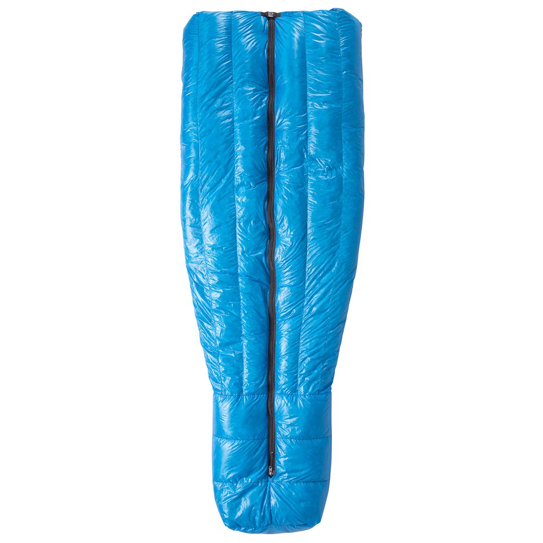
As an outdoor writer and photographer, I spend a lot of time on the trail. Long days with a fully-laden pack is part of my job so I am constantly looking for products which help me lighten the load, without a reduction in performance. A sleeping bag is one of the heaviest items that a backpacker carries and the differences in weights between products can be large. The very lightest sleeping bags are light because they incorporate the lightest products available and these are pared down to the bare minimum. Very light bags normally use goose down as the fill because it offers the most favourable warmth to weight ratio: obviously, the more fill you include, the heavier the bag. However, the outer materials of sleeping bags vary greatly from manufacturer to manufacturer. To keep weight down they tend to be very thin. And very thin material is often not very durable so that is something that I pay close attention to. The holy grail of sleeping bags is therefore one that is very warm, very light and very durable. And I have to say that Zpacks’ Full Zip Sleeping Bag is as close to perfection as I have seen.
However, before we get into that in detail, let’s go over a few basic facts about sleeping bags. Each bag has a ‘comfort rating’: this is the lowest temperature at which the standard woman should enjoy a comfortable night’s sleep. There is also a ‘lower comfort limit’ which is for men. That may sound simple but it is not. Although all reputable sleeping bag manufacturers use the same independent standard, the bags are not tested in the same place so there is a lack of consistency amongst ratings. Also, the ratings are designed with an average man and woman in mind but every person is different: some people get colder than others. The ratings should therefore be used as a guide only and it is wise to choose a bag with a comfort rating which is a few degrees lower than the night temperatures that you will encounter. I have used a lot of sleeping bags over the years but have rarely found that the very lightest bags perform well at the lower end of their intended temperature range. Now it is fair to say that, as I am skinny, I tend to ‘sleep cold’ and am therefore pushing my sleep systems to the limit: I rarely find that I can get a comfortable night’s sleep if outside temperatures drop to the bottom of the sleeping bag’s comfort limit. Accordingly, I think that my body provides science with a sensible guinea pig to test bags in the real world.
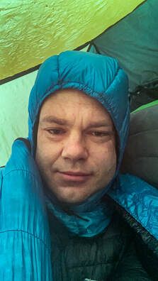
Fitting At 183cm tall, I was in the middle between the medium and the long size. I chose the long length and I did not regret this choice. Zpacks’ sizing seems very accurate. Although, it was slightly too long for me, it has no integrated hood so I was able to snuggle down and pull the material up around the side of my head. I hate having my feet wedged against the bottom of a smaller bag. Anybody slightly smaller than me might go for the medium.
The outer is water-repellent and the down is water-resistant so I found that the bag did not lose heat even when the outer was damp with condensation. This is a very important consideration when cold weather camping because condensation is unavoidable. The draft tube along the zip was effective and I did not feel that much heat escaped from there. I found no ‘dead spots’ in the insulation either: it is obvious that this is a premium product. I liked the draw cord which was thin but easily strong enough. It is clear that many manufacturers are over-specing drawcords. I also liked the clip at the top of the zip which stops unintentional unzipping. I was concerned about the lack of an integrated hood but in fact, this has completely changed the way that I look at sleeping bags. The separate goose hood was a revelation for a front/side sleeper like me. You can twist and turn in the sleeping bag without the main body of the bag turning too. This ensures that you stay warm all night. It works so much better than an integrated hood if you do not sleep on your back. My only slight niggle is the zip which seems overly robust and heavy compared to the zips used by some other manufacturers such as Thermarest. Could there be a potential weight-saving here?
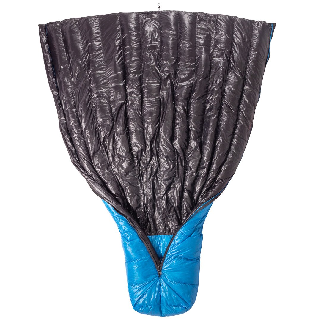
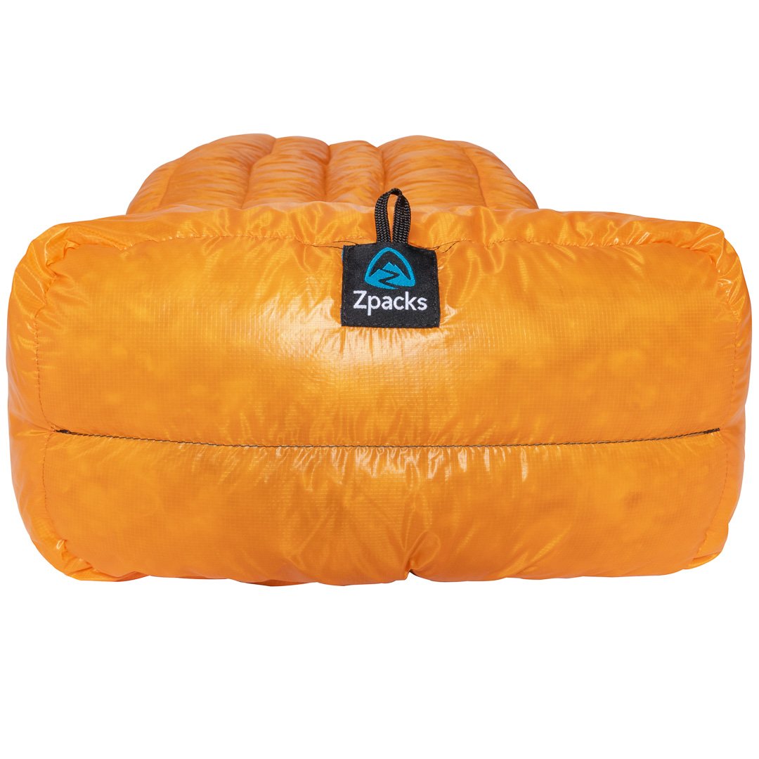
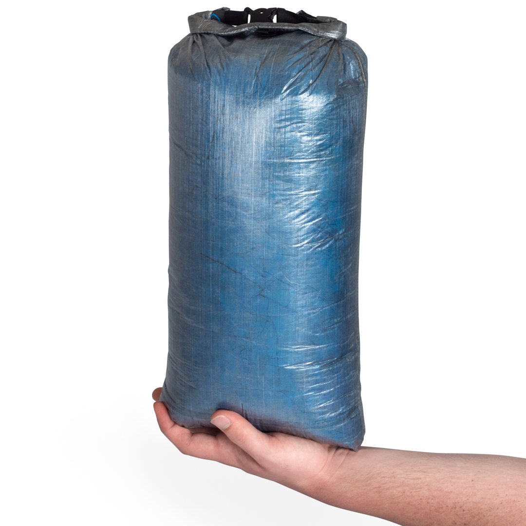
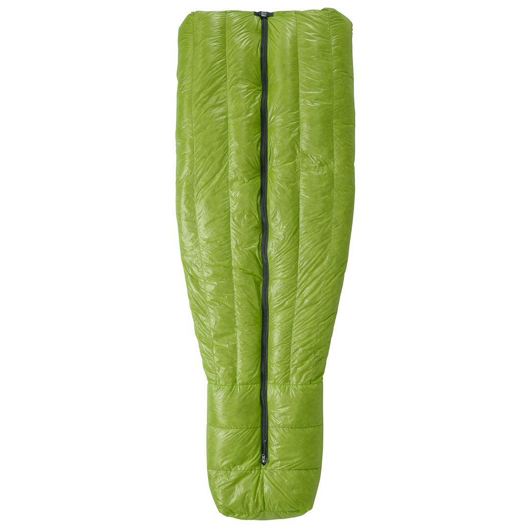
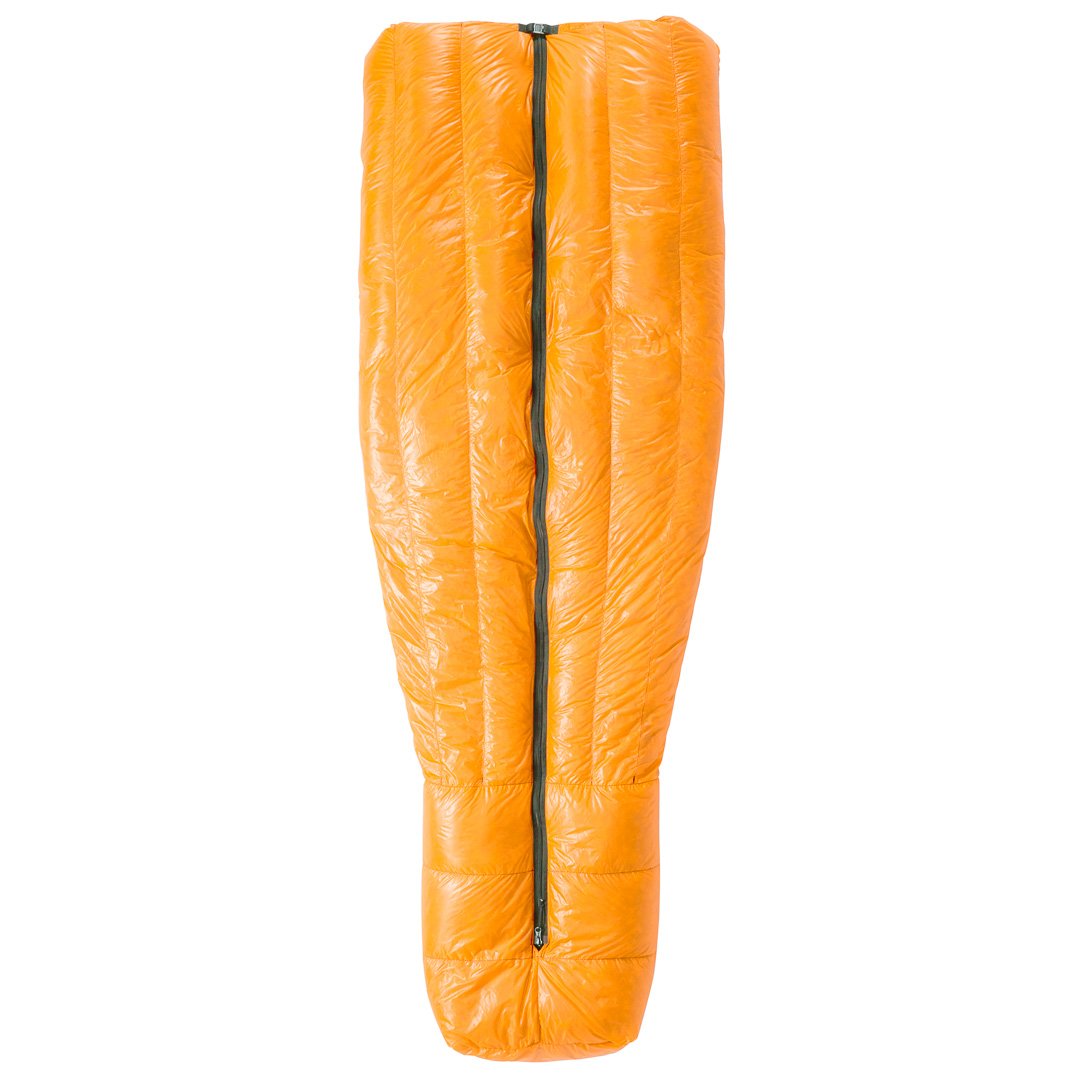
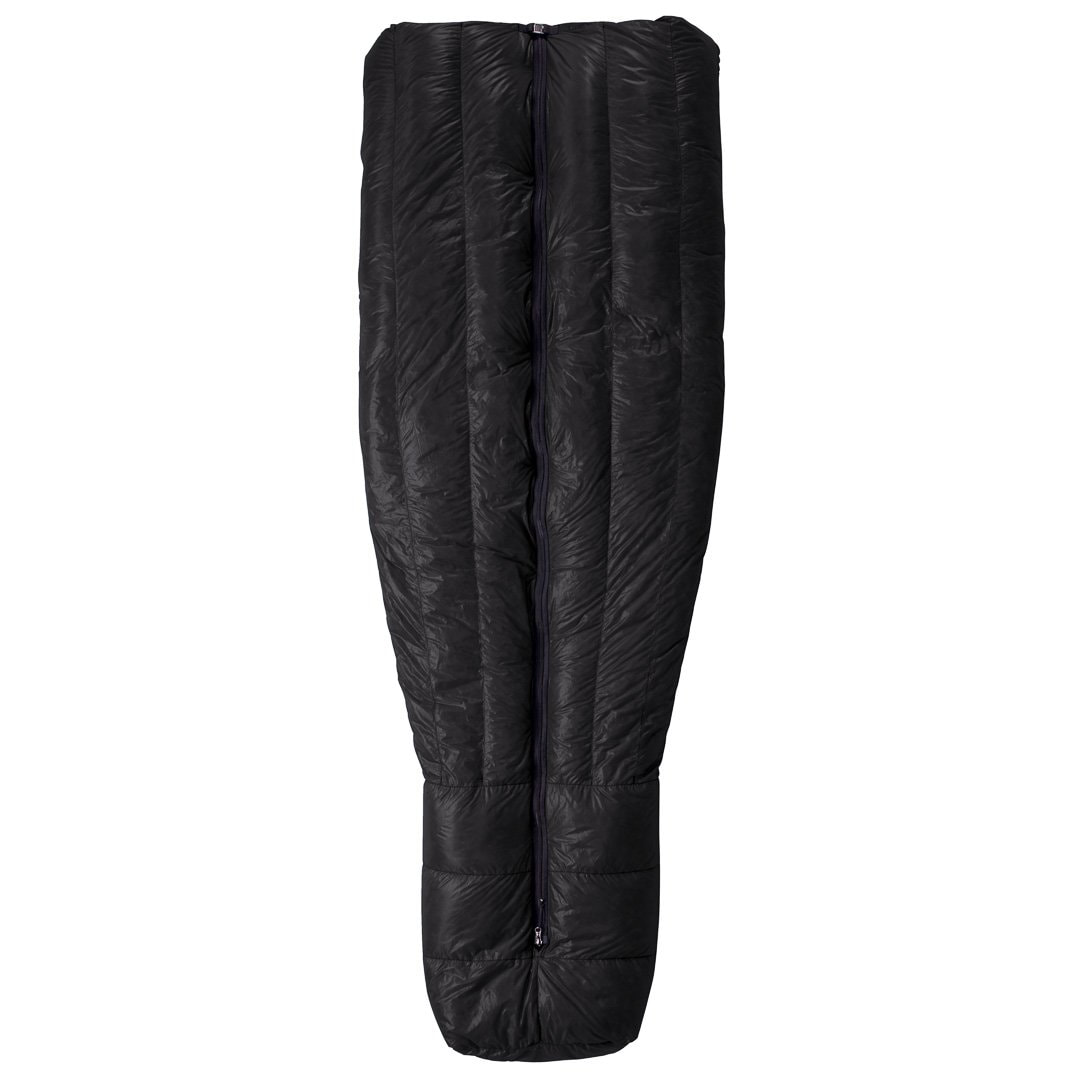
Durability: Backpacking in the wild puts a lot of pressure on gear. However, over 7 days I noticed no wear at all on the outer and I found it to be very robust. Of course, there will be bags that have tougher outers but not at this weight. Personally, I would rather carry a very light bag and try to take good care of it. Conclusion The Zpacks’ Full Zip Sleeping Bag 10F is now my ‘go-to’ bag for backpacking in temperatures below zero. It has easily the best ratio of warmth to weight that I have ever experienced and it is the lightest bag I have ever used that actually keeps me warm at -8°C. I expect that those who sleep warm would easily be able to use it down to 10F/-12°C. Unlike many other bags, it has both water-resistant outer and down which is an important and much-overlooked characteristic. It also comes with a waterproof Dyneema bag which is extremely tough and light. The outer seems to be sufficiently robust if you take good care of it. The full zip provides welcome flexibility: if you ever get too warm you can simply stick your feet out the bottom. Bags with ¾ length zips do not allow for that. At $469, it is not cheap but if you like to travel ultralight then it is a price worth paying. Without hesitation, I would honestly say that this is the gold standard for sleeping bags. And it comes in four different colours: see images below. If I had to find a fault, it would be the zip which seems to be a little over-speced. Could Zpacks not save even more weight by using a lighter zip such as the one on the Thermarest Hyperion? But honestly, that is the only fault I can find with this exceptional sleeping bag
Andrew McCluggage is an outdoor writer and photographer. He is also the CEO of Knife Edge Outdoor Guidebooks. He has written a large number of books for walking and trekking including Tour du Mont Blanc, Trekking the Dolomites AV1, Trekking the Corsica GR20, Trekking the West Highland Way, Trekking the Hadrian’s Wall Path and The Haute Route: Chamonix to Zermatt. Follow Andrew on Facebook and Instagram: @knifeedgeoutdoor Tour du Mont Blanc (2022 updated version)
£16.99
AVAILABLE NOW!
Complete guidebook for planning and trekking the Tour du Mont Blanc, the world's most famous trek Real maps for each stage: 1:25,000. No need to carry a separate map! Unique Itinerary Planner: plan a bespoke itinerary to match your ability and vacation schedule. All difficult calculations of time, distance and altitude gain are done for you Everything the trekker needs to know: route descriptions, costs, budget, difficulty, weather, how to get there, and more Full accommodation listings: spectacularly situated mountain huts, villages and hamlets Full section on camping: a complete list of camping locations 10 exciting variants to the main route! Information for both self-guided and guided trekkers Trekking the West Highland Way: Two-way guide
£16.99
Available Now! The definitive two-way guide to the West Highland Way: both northbound and southbound routes are described in full. Real Maps: Full Ordnance Survey Explorer mapping inside (1:25,000) 17 different itineraries: schedules of 3, 4, 5, 6, 7, 8, 9, 10 and 11 days for hikers and runners. Includes both southbound and northbound itineraries. Difficult calculations of time, distance and altitude gain are done for you. Also includes:
Trekking the Dolomites AV1 (2024 updated version)
£16.99
Fully Updated for 2024! The only guidebook exclusively for the AV1. Real maps inside (Tabacco 1:25,000): the finest maps available for the Dolomites. Everything you need to know to plan and walk Italy's most popular long distance route. Also includes: Numbered waypoints linking maps to text Unique Itinerary Planner: plan a bespoke itinerary to match your ability and vacation schedule. All difficult calculations of time, distance and altitude gain are done for you 7 Proposed Itineraries of between 6 and 11 days Everything the trekker needs to know to plan the route: route descriptions, costs, budget, difficulty, weather, how to get there, and more Full accommodation listings: spectacularly situated mountain huts Section on Camping Exciting variants to the main route Information for both self-guided and guided trekkers Edge to edge colour: the most modern and beautiful guidebooks Walking Chamonix Mont Blanc
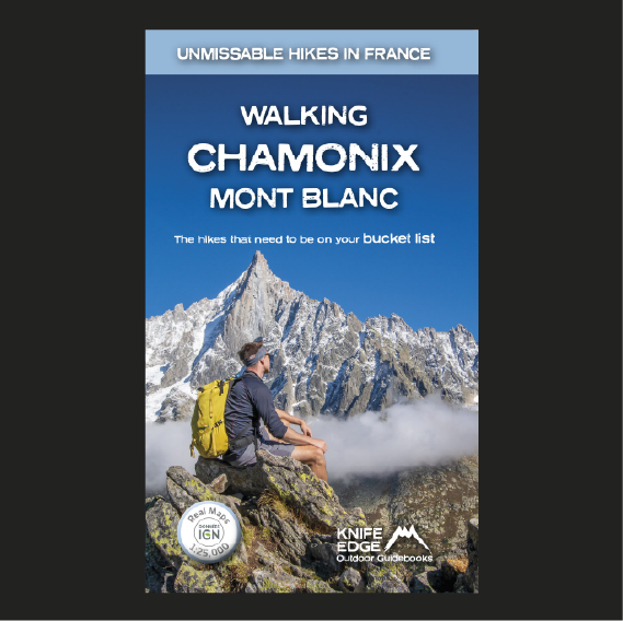
£15.99
Available Now!
The 20 hikes in the Chamonix Valley that need to be on your Bucket List. No fillers. Only must-do hikes are included. ► Real IGN Maps inside: 1:25,000 ► Detailed information on public transport, including cable cars ► Our secret tips on how to get away from the crowds ► Numbered waypoints linking the Real Maps to our clear descriptions ► Graded routes to suit all abilities ► Everything the hiker needs to know: route descriptions, difficulty, weather, how to get there, and more ► Information on Wildlife and Plants Our walks have been carefully selected to enable easy access by public transport, including the Chamonix Valley’s incredible cable car network. Chamonix is the most famous mountain town in the world. It is where mountaineering began. Its peerless reputation owes everything to the mighty Mont Blanc, the highest peak in Western Europe: our hikes will take you to the finest viewpoints of the mountain and its glaciers. Walker's Haute Route: Chamonix to Zermatt
£14.99
AVAILABLE NOW!
Real maps for each stage: 1:25,000/1:50,000. No need to carry a separate map! Also includes:
Trekking the Corsica GR20
£15.99
Available now! The only two-way guide to the GR20: both northbound and southbound routes are described in full. Real IGN Maps included (1:25,000): no need to carry separate maps. 15 different itineraries: schedules of 9, 10, 11, 12, 13, 14, 15 and 16 days. Includes both northbound and southbound itineraries. Difficult calculations of time, distance and altitude gain are done for you. Also includes:
Trekking the Hadrian’s Wall Path (2024 Updated Version)
£16.99
Available now! Real OS maps 1:25,000 The definitive two-way guide to the Hadrian’s Wall Path: both eastbound and westbound routes are described in full. 14 different itineraries: schedules of 3, 4, 5, 6, 7, 8 and 9 days for walkers and runners. Includes both northbound and southbound itineraries. Difficult calculations of time, distance and altitude gain are done for you. Also includes:
Hadrian’s Wall was one of the Romans’ most ambitious structures. When completed, it ran for 73 miles between the west and east coasts of Northern England. It crossed the crags and hills of some of Britain’s wildest and most beautiful terrain. The Hadrian’s Wall path is one of England’s official ‘National Trails’. It leads you on an unforgettable journey of discovery along the route of the Wall. Discover the incredible surviving sections of the Wall and its forts, milecastles and turrets. Trekking the Mallorca GR221
£16.99
Available Now! The definitive two-way guide to the Mallorca GR221 (the Drystone Way): both northbound and southbound routes are described in full. Real Maps: Full mapping inside (1:25,000) by Editorial Alpina. All accommodation is numbered and marked on the maps. 12 different itineraries: schedules of 7, 8, 9, 10 and 11 days for hikers and runners. Includes both northbound and southbound itineraries. Difficult calculations of time, distance and altitude gain/loss are done for you. Also includes:
Trekking Iceland's Laugavegur Trail (& Fimmvörðuháls Trail)
£17.99
Available Now! The definitive two-way guide to Iceland's Laugavegur Trail (& Fimmvörðuháls Trail): both southbound and northbound routes are described in full. Real Maps: full mapping inside (1:40,000), made specifically for the treks by Knife Edge Outdoor Guidebooks. All accommodation/campsites are numbered and marked on the maps. 14 different itineraries: schedules of 2, 3, 4, 5, 6 and 7 days for hikers and runners. Includes both southbound and northbound itineraries. Difficult calculations of time, distance and altitude gain/loss are done for you. Also includes:
Trekking Map: Iceland's Laugavegur Trail (& Fimmvörðuháls Trail)
£16.99
Available Now! Waterproof sheet map for Iceland's Laugavegur Trail (& Fimmvörðuháls Trail): 1:40,000. Includes free GPX downloads for the trails. The definitive map to Iceland’s two best trails: larger scale and more detail than any other map. Made specifically for the treks by Knife Edge Outdoor Guidebooks.
The Laugavegur Trail is one of the world's most beautiful and aspirational treks. It leads you into the heart of Iceland’s unique ice-capped, volcanic terrain. Experience spectacular and unusual landscapes, the likes of which you will not find anywhere else on the planet. Impressive volcanic peaks are a constant companion and steam gushes from the ground. This is Iceland at its best and it will be an adventure that you will never forget Everest Base Camp: Trekking Map (includes Classic EBC, Three Passes & Gokyo Lakes)
£16.99
Available now! The best sheet map for the Everest treks: Classic EBC, Three Passes & Gokyo Lakes (all clearly colour coded). 1:40,000 - larger scale and more detail than any other Everest map. Perfect for planning and navigation. Includes walk-in route to Lukla Made specifically for the Everest treks by Knife Edge Outdoor Guidebooks:
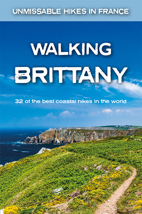
Walking Brittany
£14.99
Available Now!
32 epic coastal walks Brittany in France Real IGN Maps inside: 1:25,000. No ‘fillers’! Only unmissable walks made the cut. Wild coastline: towering cliffs, remote headlands, forgotten islands and stunning beaches which would not be out of place on a Caribbean island. 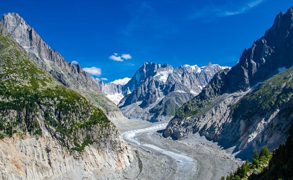 The Mer de Glace seen from Signal Forbes People are constantly asking me how they should spend their spare days in Chamonix after trekking the TMB. So here is a link to an article I have written on my bucket list of epic viewpoints in the Chamonix Valley. These are the places which you simply CAN NOT miss! It should help you start your planning. 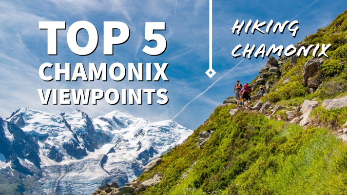
Walking Chamonix Mont Blanc
£15.99
Available Now!
The 20 hikes in the Chamonix Valley that need to be on your Bucket List. No fillers. Only must-do hikes are included. ► Real IGN Maps inside: 1:25,000 ► Detailed information on public transport, including cable cars ► Our secret tips on how to get away from the crowds ► Numbered waypoints linking the Real Maps to our clear descriptions ► Graded routes to suit all abilities ► Everything the hiker needs to know: route descriptions, difficulty, weather, how to get there, and more ► Information on Wildlife and Plants Our walks have been carefully selected to enable easy access by public transport, including the Chamonix Valley’s incredible cable car network. Chamonix is the most famous mountain town in the world. It is where mountaineering began. Its peerless reputation owes everything to the mighty Mont Blanc, the highest peak in Western Europe: our hikes will take you to the finest viewpoints of the mountain and its glaciers. 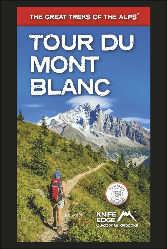
Tour du Mont Blanc (2022 updated version)
£16.99
AVAILABLE NOW!
Complete guidebook for planning and trekking the Tour du Mont Blanc, the world's most famous trek Real maps for each stage: 1:25,000. No need to carry a separate map! Unique Itinerary Planner: plan a bespoke itinerary to match your ability and vacation schedule. All difficult calculations of time, distance and altitude gain are done for you Everything the trekker needs to know: route descriptions, costs, budget, difficulty, weather, how to get there, and more Full accommodation listings: spectacularly situated mountain huts, villages and hamlets Full section on camping: a complete list of camping locations 10 exciting variants to the main route! Information for both self-guided and guided trekkers 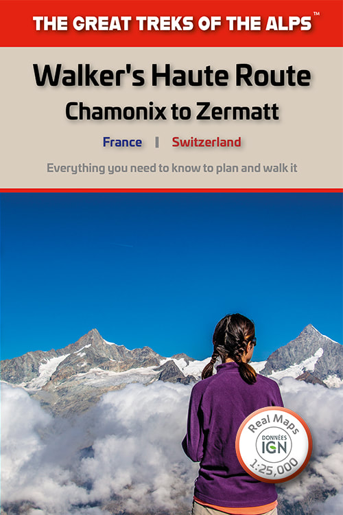
Walker's Haute Route: Chamonix to Zermatt
£14.99
AVAILABLE NOW!
Real maps for each stage: 1:25,000/1:50,000. No need to carry a separate map! Also includes:
Trekking the Dolomites AV1 (2024 updated version)
£16.99
Fully Updated for 2024! The only guidebook exclusively for the AV1. Real maps inside (Tabacco 1:25,000): the finest maps available for the Dolomites. Everything you need to know to plan and walk Italy's most popular long distance route. Also includes: Numbered waypoints linking maps to text Unique Itinerary Planner: plan a bespoke itinerary to match your ability and vacation schedule. All difficult calculations of time, distance and altitude gain are done for you 7 Proposed Itineraries of between 6 and 11 days Everything the trekker needs to know to plan the route: route descriptions, costs, budget, difficulty, weather, how to get there, and more Full accommodation listings: spectacularly situated mountain huts Section on Camping Exciting variants to the main route Information for both self-guided and guided trekkers Edge to edge colour: the most modern and beautiful guidebooks 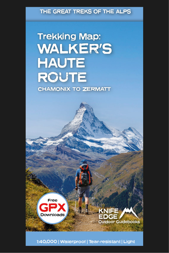
Trekking Map: Walker’s Haute Route: Chamonix to Zermatt: 1:40,000 mapping; Free GPX downloads
£16.99
Available Now
The best sheet map for the Walker’s Haute Route: Chamonix to Zermatt. This is the only map available that displays the entire route and numerous variants on a single sheet: perfect for planning and navigation. 1:40,000: larger scale and more detail than any other map. 1:10,000: for select areas where navigation is challenging. Made specifically for the Walker’s Haute Route by Knife Edge Outdoor Guidebooks:
Trekking the Tour des Combins: Two-way Guide: 1:40k mapping; 10 different itineraries
£18.99
The definitive guidebook for the Tour des Combins: the new bucket list trek in the Swiss/Italian Alps. A superb alternative to the more famous Tour du Mont Blanc. Two-way guide: both clockwise and anti-clockwise routes are described in full. Real Maps: full mapping inside (1:40,000), made specifically for Knife Edge Outdoor Guidebooks. All accommodation/campsites are numbered and marked on the maps. 10 different itineraries: schedules of 6, 7, 8 and 9 days for hikers and runners. Includes both clockwise and anti-clockwise itineraries. Difficult calculations of time, distance and altitude gain/loss are done for you.
Also includes:
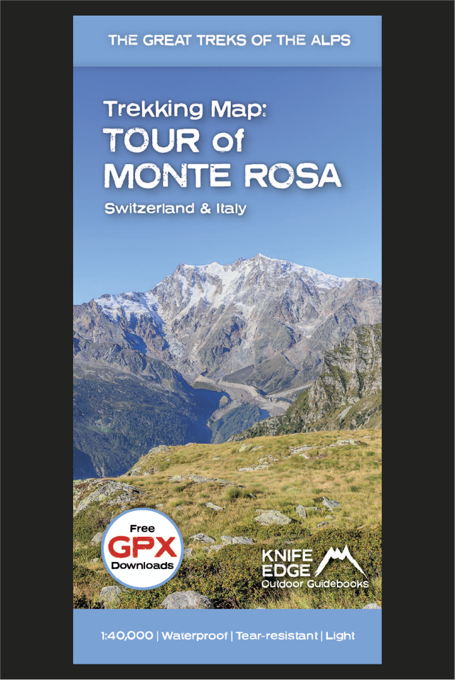
Tour of Monte Rosa: Trekking Map
£16.99
Available now! The best sheet map for the Tour of Monte Rosa. Displays the entire route and variants on a single sheet: perfect for planning and navigation. 1:40,000 - larger scale and more detail than any other map. Made specifically for the Tour of Monte Rosa by Knife Edge Outdoor Guidebooks:
The Tour of Monte Rosa is one of the classic Alpine treks. It leads the trekker on an epic circuit around the Monte Rosa massif. The largest group of 4000m peaks in the Alps is on display: the Weisshorn, the Zinalrothorn, the Dom, the Täschhorn, the Breithorn and the Matterhorn, to name a few. It is the sister trek to the Walker’s Haute Route and crosses unspoilt and remote mountain terrain: amazing glaciers, snow frosted summits, beautiful valleys and pastures, shimmering lakes, carpets of wild flowers and the soothing sound of cow bells. This trek should be on your hiking bucket list 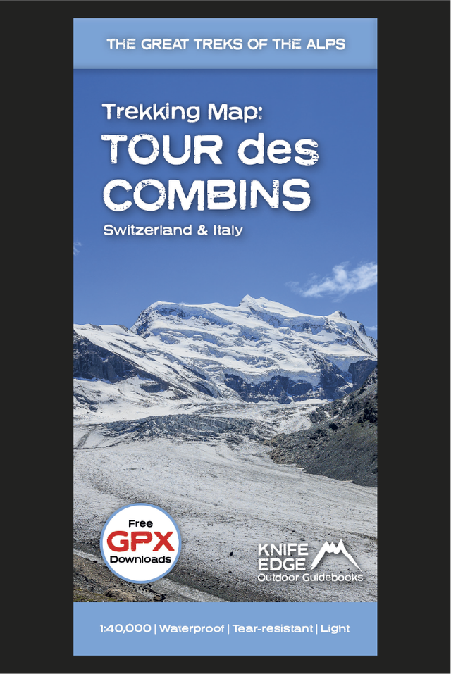
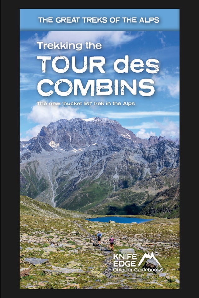
Tour des Combins: Trekking Map
£16.99
Available now! The best sheet map for the Tour des Combins. Displays the entire route and variants on a single sheet: perfect for planning and navigation. 1:40,000 - larger scale and more detail than any other map. Made specifically for the Tour des Combins by Knife Edge Outdoor Guidebooks:
The Tour des Combins is an epic trek in the Swiss and Italian Alps. It traverses some of Europe's wildest mountain terrain. The sublime scenery makes it a worthy alternative to the more famous Tour du Mont Blanc (which is only a stone's throw away). Hike along the edge of the Corbassière Glacier, one of the longest in Europe. Enjoy snow frosted summits, magnificent valleys and pastures, sparkling azure lakes, carpets of wild flowers, the soothing sound of cow bells and easy to follow paths. Stay in spectacularly situated villages and remote mountain huts. This will be a trip that you will never forget 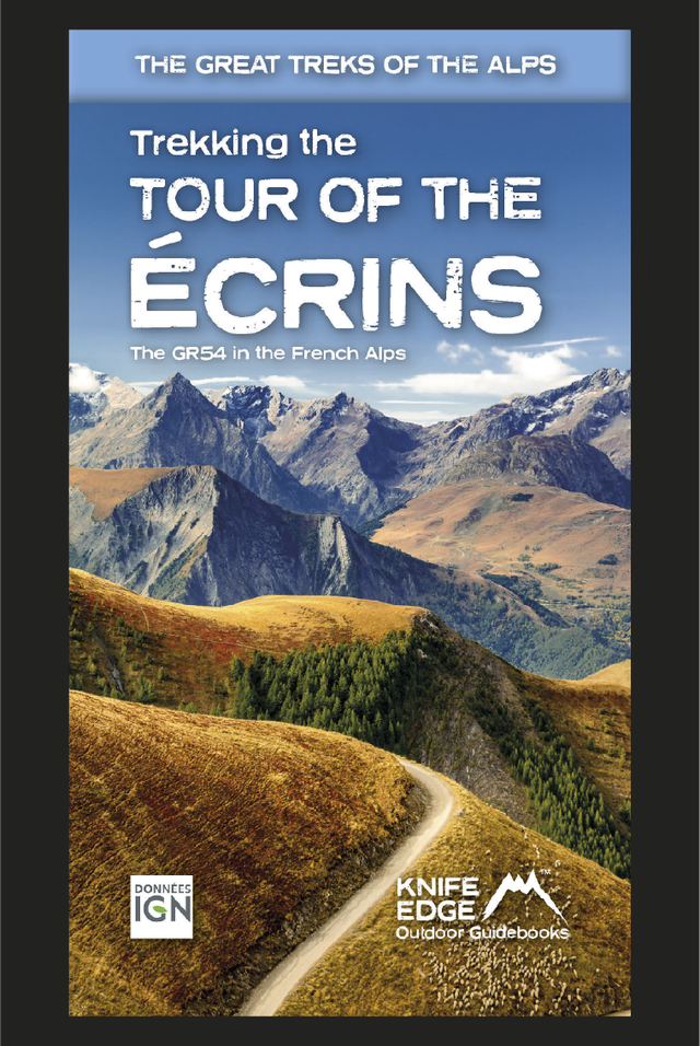
Tour of the Ecrins National Park (2nd Edition)
£18.99
AVAILABLE NOW 2nd Edition: fully re-written and updated for 2024 Complete guidebook for planning and trekking the GR54 which is arguably the finest trek in the Alps.
Walking Brittany
£14.99
Available Now!
32 epic coastal walks Brittany in France Real IGN Maps inside: 1:25,000. No ‘fillers’! Only unmissable walks made the cut. Wild coastline: towering cliffs, remote headlands, forgotten islands and stunning beaches which would not be out of place on a Caribbean island.  The AV1 starts at the magnificent Lago di Braies It is no exaggeration to state that the Dolomites AV1 is one of the world’s most beautiful treks. And it is therefore no surprise to learn that it is also very busy. In a normal year, in July and August, almost every bed in every refuge, gîte and hotel will eventually be booked up and not just by AV1 trekkers: weekenders and day walkers also want to experience this magnificent terrain. Of course, Covid changed the world and 2020 was a very different year. Travelling to the Dolomites was a challenge for those who did not reside in Continental Europe and few English-speaking trekkers have walked this year. Even the number of UK trekkers willing or able to cross the English Channel was very small. Those that did find a way to get to the Dolomites had an overwhelmingly positive experience: walker numbers were far fewer than at any other time in recent years and you could sometimes book accommodation at the last minute. Often people had to move heaven and earth to get there but they were richly rewarded, enjoying an exceptional Alpine ‘honeypot’ without the crowds. Italy had its serious Covid outbreak before other western countries and as a result, it was one of the first to recover. Whilst Covid is still present, it appears that the situation is being kept under control. Those that did trek in 2020 have mostly reported that they felt very safe. The rifugi, by all accounts, handled Covid very well and the sanitary and distancing measures that they put in place seemed to please most.
However, I think that those desperate to walk the AV1 should not put plans completely on hold. The Dolomites trekking season is very short (approximately 10-12 weeks depending on the year). With a popular trek like the AV1, it can be difficult to get the stars to align to get on the trek within this short period. And these days, it is very difficult to plan the AV1 at the last minute if you are not camping. We do not get much notice when governments change rules or when airlines start up flights again. If you have not done some planning and preparation before that happens then you will probably miss out. Those who have already done their homework will be able to move faster. Furthermore, because so many people missed out in 2020, there is going to be massive pent-up demand for the AV1 in the next few years. And the rifugi will probably continue to run at reduced capacity in the next few seasons. Accordingly, AV1 accommodation for the foreseeable future is going to be like gold dust. 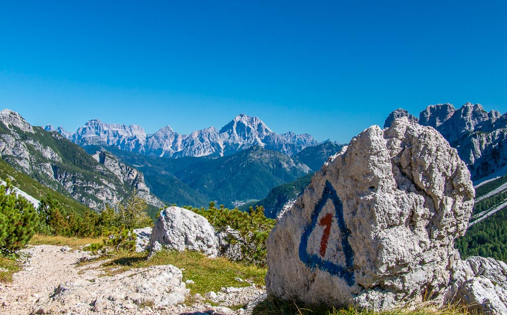 An AV1 marker on the route to Rifugio Pramperet So, this is what I think you should do: Plan your itinerary now: buy the guidebooks and maps; work out how many days you want to spend on the trek; design an itinerary that matches your capabilities and vacation schedule; and make a list of the places you want to stay. Take your time. Get yourself into a position to be able to start booking accommodation the moment that you feel it is right to do so. Forget about flights for now: those can be booked later on, if and when, they become available. If they do not become available, then you have not wasted any time: your itinerary planning work will still be good for the following season. Consider booking AV1 accommodation: there are ways of booking accommodation so that it can be cancelled later or moved to future dates. Most of those who booked for 2020, but could not travel, obtained refunds or were permitted to shift their dates to subsequent seasons. If done right, you should not lose any money if you have to cancel or postpone. If booking accommodation independently, choose rifugi/hotels that allow cancellation or amendment. Or book with a self-guided/guided tour company that allows you to cancel or change your dates. In any case, most accommodation requires only small deposits of €15-20 so the risk is not huge. If you start booking in October 2020, then you should get the choice accommodation: private rooms, etc. If you wait until flights open up next year than you may get nothing. If travel is impossible next year then you should have lost nothing more than a little time. On the other hand, if you do not put the work in now then it seems likely that you will miss out with the accommodation operating at such reduced capacity. Please feel free to ask me any questions!
 Finish the TMB on this incredible balcony below le Brevent It is no exaggeration to state that the Tour du Mont Blanc is exquisite. And it is therefore no surprise to learn that it is also very busy. In a normal year, in July and August, almost every bed in every refuge, gîte and hotel will eventually be booked up and not just by TMB trekkers: weekenders and day walkers also want to experience this magnificent terrain. Of course, Covid changed the world and 2020 was a very different year. Travelling to the Alps was a challenge for those who did not reside in Continental Europe and few English-speaking trekkers have walked this year. Even the number of UK trekkers willing or able to cross the English Channel was very small. Those that did find a way to get to the Chamonix Valley had an overwhelmingly positive experience: walker numbers were far fewer than at any other time in the modern TMB era and you could sometimes book accommodation at the last minute. Often people had to move heaven and earth to get there but they were richly rewarded, enjoying an exceptional Alpine ‘honeypot’ without the crowds. Those that did trek in 2020 have mostly reported that they felt very safe. The refuges, by all accounts, handled Covid very well and the sanitary and distancing measures that they put in place seemed to please most.
But what the hell do I know?! Well, while I cannot profess to be an expert on contagious disease or economics, I do know that the current environment is deterring most people from making travel plans, especially in places like the US where Covid has continued to spread over the summer. Most people will wait for flights actually to open up before starting to plan a trip. There is of course common sense to this: what is the point of planning a trip if there is no way of getting there? However, I think that those desperate to walk the TMB should not put plans completely on hold. The Alpine trekking season is very short (approximately 10-12 weeks depending on the year). With a popular trek like the TMB, it can be difficult to get the stars to align to get on the trek within this short period. And these days, it is almost impossible to plan the TMB at the last minute if you are not camping. We do not get much notice when governments change rules or when airlines start up flights again. If you have not done some planning and preparation before that happens then you will miss out. Furthermore, because so many people missed out in 2020, there is going to be massive pent-up demand for the TMB in the next few years. And the refuges will probably continue to run at reduced capacity in the next few seasons. Accordingly, TMB accommodation for the foreseeable future is going to be like gold dust.  Col de la Croix du Bonhomme on the TMB So, this is what I think you should do:
If travel is impossible next year then you should have lost nothing more than a little time. On the other hand, if you do not put the work in now then it seems likely that you will miss out with the accommodation operating at such reduced capacity. Please feel free to ask me any questions!
Walking Chamonix Mont Blanc
£15.99
Available Now!
The 20 hikes in the Chamonix Valley that need to be on your Bucket List. No fillers. Only must-do hikes are included. ► Real IGN Maps inside: 1:25,000 ► Detailed information on public transport, including cable cars ► Our secret tips on how to get away from the crowds ► Numbered waypoints linking the Real Maps to our clear descriptions ► Graded routes to suit all abilities ► Everything the hiker needs to know: route descriptions, difficulty, weather, how to get there, and more ► Information on Wildlife and Plants Our walks have been carefully selected to enable easy access by public transport, including the Chamonix Valley’s incredible cable car network. Chamonix is the most famous mountain town in the world. It is where mountaineering began. Its peerless reputation owes everything to the mighty Mont Blanc, the highest peak in Western Europe: our hikes will take you to the finest viewpoints of the mountain and its glaciers. Walker's Haute Route: Chamonix to Zermatt
£14.99
AVAILABLE NOW!
Real maps for each stage: 1:25,000/1:50,000. No need to carry a separate map! Also includes:
Trekking the Dolomites AV1 (2024 updated version)
£16.99
Fully Updated for 2024! The only guidebook exclusively for the AV1. Real maps inside (Tabacco 1:25,000): the finest maps available for the Dolomites. Everything you need to know to plan and walk Italy's most popular long distance route. Also includes: Numbered waypoints linking maps to text Unique Itinerary Planner: plan a bespoke itinerary to match your ability and vacation schedule. All difficult calculations of time, distance and altitude gain are done for you 7 Proposed Itineraries of between 6 and 11 days Everything the trekker needs to know to plan the route: route descriptions, costs, budget, difficulty, weather, how to get there, and more Full accommodation listings: spectacularly situated mountain huts Section on Camping Exciting variants to the main route Information for both self-guided and guided trekkers Edge to edge colour: the most modern and beautiful guidebooks Tour of the Ecrins National Park (2nd Edition)
£18.99
AVAILABLE NOW 2nd Edition: fully re-written and updated for 2024 Complete guidebook for planning and trekking the GR54 which is arguably the finest trek in the Alps.
Tour du Mont Blanc (2022 updated version)
£16.99
AVAILABLE NOW!
Complete guidebook for planning and trekking the Tour du Mont Blanc, the world's most famous trek Real maps for each stage: 1:25,000. No need to carry a separate map! Unique Itinerary Planner: plan a bespoke itinerary to match your ability and vacation schedule. All difficult calculations of time, distance and altitude gain are done for you Everything the trekker needs to know: route descriptions, costs, budget, difficulty, weather, how to get there, and more Full accommodation listings: spectacularly situated mountain huts, villages and hamlets Full section on camping: a complete list of camping locations 10 exciting variants to the main route! Information for both self-guided and guided trekkers Trekking Map: Walker’s Haute Route: Chamonix to Zermatt: 1:40,000 mapping; Free GPX downloads
£16.99
Available Now
The best sheet map for the Walker’s Haute Route: Chamonix to Zermatt. This is the only map available that displays the entire route and numerous variants on a single sheet: perfect for planning and navigation. 1:40,000: larger scale and more detail than any other map. 1:10,000: for select areas where navigation is challenging. Made specifically for the Walker’s Haute Route by Knife Edge Outdoor Guidebooks:
Trekking the Tour des Combins: Two-way Guide: 1:40k mapping; 10 different itineraries
£18.99
The definitive guidebook for the Tour des Combins: the new bucket list trek in the Swiss/Italian Alps. A superb alternative to the more famous Tour du Mont Blanc. Two-way guide: both clockwise and anti-clockwise routes are described in full. Real Maps: full mapping inside (1:40,000), made specifically for Knife Edge Outdoor Guidebooks. All accommodation/campsites are numbered and marked on the maps. 10 different itineraries: schedules of 6, 7, 8 and 9 days for hikers and runners. Includes both clockwise and anti-clockwise itineraries. Difficult calculations of time, distance and altitude gain/loss are done for you.
Also includes:
Tour of Monte Rosa: Trekking Map
£16.99
Available now! The best sheet map for the Tour of Monte Rosa. Displays the entire route and variants on a single sheet: perfect for planning and navigation. 1:40,000 - larger scale and more detail than any other map. Made specifically for the Tour of Monte Rosa by Knife Edge Outdoor Guidebooks:
The Tour of Monte Rosa is one of the classic Alpine treks. It leads the trekker on an epic circuit around the Monte Rosa massif. The largest group of 4000m peaks in the Alps is on display: the Weisshorn, the Zinalrothorn, the Dom, the Täschhorn, the Breithorn and the Matterhorn, to name a few. It is the sister trek to the Walker’s Haute Route and crosses unspoilt and remote mountain terrain: amazing glaciers, snow frosted summits, beautiful valleys and pastures, shimmering lakes, carpets of wild flowers and the soothing sound of cow bells. This trek should be on your hiking bucket list Tour des Combins: Trekking Map
£16.99
Available now! The best sheet map for the Tour des Combins. Displays the entire route and variants on a single sheet: perfect for planning and navigation. 1:40,000 - larger scale and more detail than any other map. Made specifically for the Tour des Combins by Knife Edge Outdoor Guidebooks:
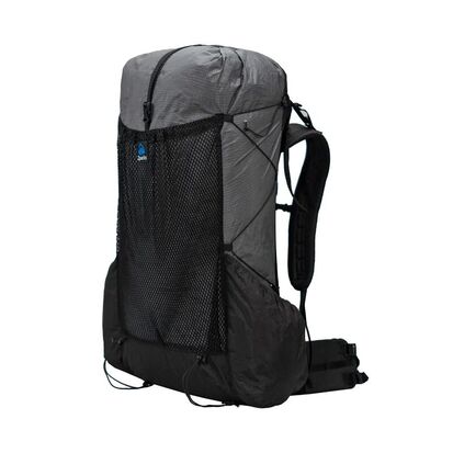
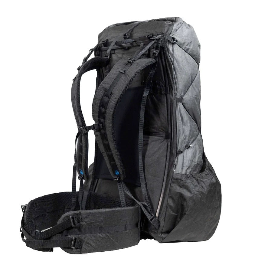
The Tour des Combins is an epic trek in the Swiss and Italian Alps. It traverses some of Europe's wildest mountain terrain. The sublime scenery makes it a worthy alternative to the more famous Tour du Mont Blanc (which is only a stone's throw away). Hike along the edge of the Corbassière Glacier, one of the longest in Europe. Enjoy snow frosted summits, magnificent valleys and pastures, sparkling azure lakes, carpets of wild flowers, the soothing sound of cow bells and easy to follow paths. Stay in spectacularly situated villages and remote mountain huts. This will be a trip that you will never forget As an outdoor writer and photographer, I spend a lot of time on the trail. Long days with a fully-laden pack is part of my job so I am constantly looking for products which help me lighten the load, without a reduction in performance. Often one of the heaviest things a backpacker carries is the backpack itself and the differences in weights between products can be large. The very lightest packs are light because they incorporate the lightest products available and these are pared down to the bare minimum. Very light materials tend to be very thin. And very thin material is often not very durable. The holy grail of backpacks is therefore one that is light and durable and still performs well. I have used a lot of packs over the years and have never found the very lightest packs to be very good. Sometimes the straps are too flimsy to be comfortable. Sometimes the material just does not last very long. Well the Zpacks Arc Blast 55 has changed everything for me. Over here in Europe, I had been hearing great things about Zpacks, a US manufacturer, for a few years now. So, I was very keen to get my hands on one of the packs. I chose the Zpacks Arc Blast 55 which has a good reputation in the US as an ultralight option for multi-day treks. Normally, I travel long-distance trails with a 45-litre pack which requires very careful packing to ensure that overnight gear and food fit in. The Arc Blast 55 would give me a little more space and yet at 569g it was still much lighter than 45-50 litre packs from other manufacturers.  Zpacks Arc Blast 55 Backpack on the South Downs Way
Features:
Conclusion The Arc Blast 55 is now my ‘go-to’ pack for long-distance treks. It is easily the lightest pack that I have ever used. In fact, it is almost unbelievably light. Yet I found it to be stable, durable and very comfortable. Unlike most other packs, it is almost completely waterproof. Despite the lightweight construction, it performed extremely well. At $325 it is not cheap but if you like to travel ultralight then it is a price worth paying. But can I not find any faults at all? OK then, I have just one: please Mr Zpacks can we have a whistle on the sternum strap?! Honestly, that is the only fault I can find with this exceptional backpack.
So here is my advice:
Depending upon how events play out and exactly when the refuges open, it is possible that the TMB and AV1 are the quietest they have been in decades. And that is something that I am going to see. NEVER STOP DREAMING!!!
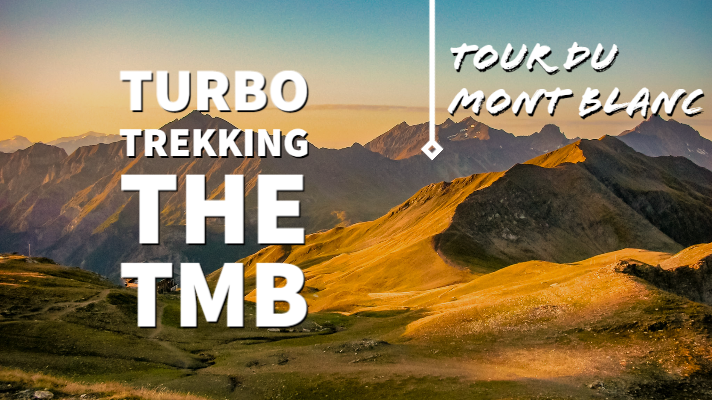 Last summer I set out to hike the Tour du Mont Blanc again. But this time I was aiming to complete it in less than 7 days. Did I succeed? I tell all in my article: just click on the link below. This article was originally published in TGO magazine in October 2019
|
Andrew McCluggageblogs about life on the Knife Edge Archives
January 2024
Categories
All
|
|||||||||||||||||||||||||||||||||||||||||||||||||||||


 RSS Feed
|
|
Free UK Delivery
International Delivery also available |

|
Company |
Support |
Follow us©Knife Edge Outdoor Guidebooks 2018
|