
What is the Tour des Combins?
.The relatively new Tour des Combins (TDC) is a spectacular trek in the Swiss and Italian Alps. In fact, it is only one narrow mountain ridge away from the famous Tour du Mont Blanc (TMB) which makes it a great trek for those who have completed the TMB and want a new challenge. And it is a perfect option for those who cannot get space on the TMB and still want to take on an Alpine trek.
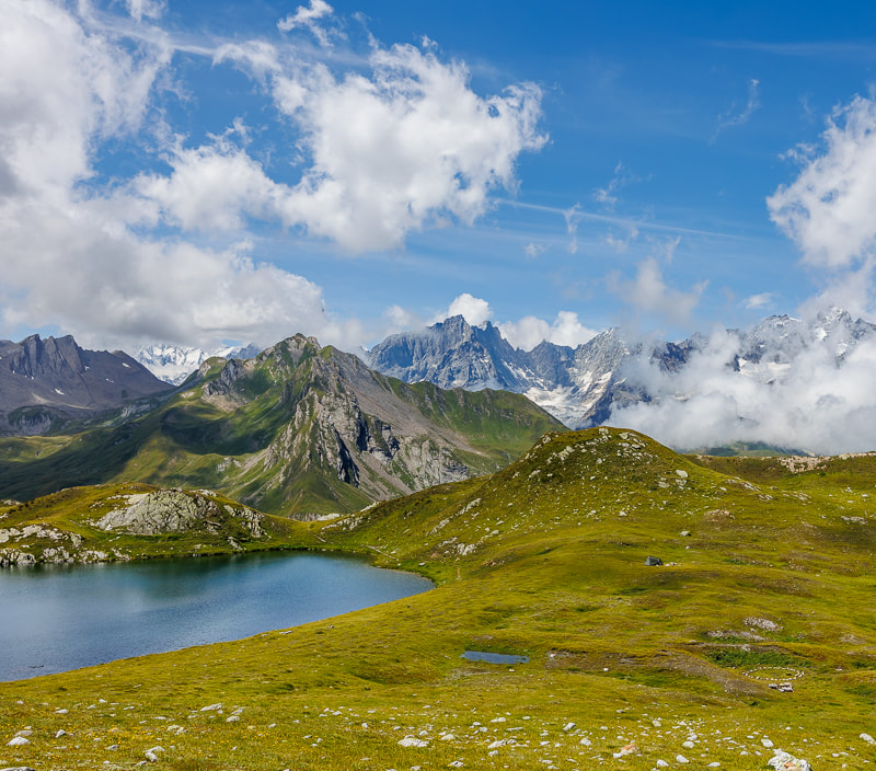
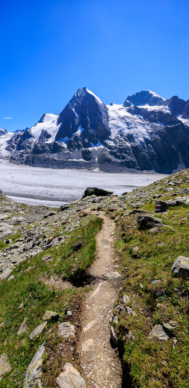
Just like its more famous contemporary, the TDC circumnavigates a spectacular alpine massif: in this case, the Grand Combins Massif (which is immediately adjacent to the Mont Blanc Massif). Clear paths and tracks lead you along spectacular ridges, across high mountain passes and through spectacular valleys. Day by day, the terrain changes and surprising new landscapes are displayed. There are jagged snow-capped peaks seemingly everywhere, shimmering alpine lakes of turquoise and blue, flower-filled pastures of the deepest green and exhilarating suspension bridges over deep chasms. And if that was not enough, the path traverses the moraine of the incredible Corbassière Glacier which, at 9.8km long, is one of the longest in Europe: you will find yourself as close to a glacier as you can get without actually stepping onto it. Like the Mont Blanc Massif, the GC Massif spans international frontiers and the trek passes through both Switzerland and Italy: the shifts in culture, language and food are highlights of the trek
Just like its more famous contemporary, the TDC circumnavigates a spectacular alpine massif: in this case, the Grand Combins Massif (which is immediately adjacent to the Mont Blanc Massif). Clear paths and tracks lead you along spectacular ridges, across high mountain passes and through spectacular valleys. Day by day, the terrain changes and surprising new landscapes are displayed. There are jagged snow-capped peaks seemingly everywhere, shimmering alpine lakes of turquoise and blue, flower-filled pastures of the deepest green and exhilarating suspension bridges over deep chasms. And if that was not enough, the path traverses the moraine of the incredible Corbassière Glacier which, at 9.8km long, is one of the longest in Europe: you will find yourself as close to a glacier as you can get without actually stepping onto it. Like the Mont Blanc Massif, the GC Massif spans international frontiers and the trek passes through both Switzerland and Italy: the shifts in culture, language and food are highlights of the trek
Basic Statistics
The TDC is 102km (64 miles) long with 6,100m (20,200ft) of ascent/descent. The highest point is Col des Otanes (2875m).
How long does it take?Most people walk the TDC in 6-7 days. However, fit and experienced hikers could finish it faster. Others prefer to walk more slowly, allowing 8 or 9 days to soak up all the delights on offer. Our guidebook sets out 10 different itineraries of 6, 7, 8 and 9 days. It really is up to you and your fitness level.
Well now that we have brought up fitness levels....Am I fit enough to do it?The TDC is a multi-day trek with significant distances to travel, and metres to climb, each day. Accordingly, a reasonable level of fitness is required. However, it is fair to say that it is far from the most difficult trek in the Alps and it is therefore an excellent option for those new to trekking. The overall distance is short compared to some other Alpine treks. And unlike some other treks, once you are ‘up’ you stay ‘up’: the TDC rarely dips below 1600m.
The sensible spacing of the mountain huts (‘rifugi’) helps too. And, with a few exceptions, the TDC is well-served by good paths and tracks: there are a few sections which are more challenging but they are relatively short. Furthermore, if you walk the conventional itinerary, the most difficult sections of the trek are undertaken towards the middle when you are ‘trail-hardened’. In summary, if you are reasonably fit then this trek should be within your capabilities. Many who have completed the TMB (the most famous Alpine trek) look to the TDC for their next trekking experience. Accordingly, it can be useful to compare these two treks. The TDC is much shorter (102km compared to 174km) and has less climbing (6,100m compared to 9,700m). Accordingly, it is usually completed more quickly than the TMB (6-7 days compared to 10-12 days). On paper therefore the TDC is the easier of the two treks. However, the bare statistics do not tell the full story and there is an additional factor which increases the difficulty of the TDC slightly: the TDC is more remote. |
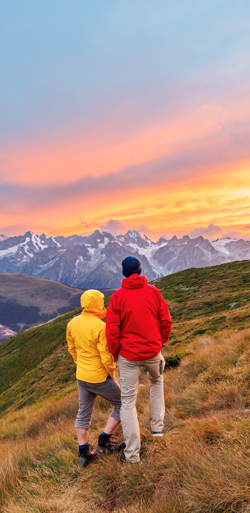
Tour des Combins Sunset Views
|
What are the trails like?
Sometimes paths are steep, rocky and challenging underfoot. Occasionally, you might have to climb up or down short sections of boulders but fortunately, you will not require any technical scrambling/climbing skills. On occasion, the route is exposed with large drops.
For the most part, the paths/tracks are clear, well-marked and simple to follow in good conditions: only occasionally is the route less obvious and more difficult to follow. Consequently, most people have no major difficulties staying on course.
For the most part, the paths/tracks are clear, well-marked and simple to follow in good conditions: only occasionally is the route less obvious and more difficult to follow. Consequently, most people have no major difficulties staying on course.
Should I go on an guided trip or walk independently?
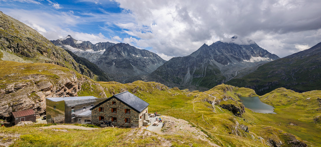
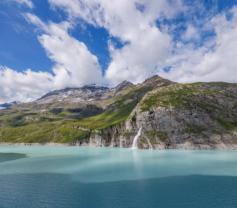
Cabane de Chanrion
Do I need to book in advance?
In July and August, forward booking is wise: these days, most people have their entire trip booked before they depart. Even outside of July and August, it is wise to book ahead, particularly at weekends and for places where there is only one place to stay. In June and September, fewer people walk the route so there is less demand for accommodation: you can sometimes still get away with only booking a day or two in advance but you might be unlucky and end up without anywhere to stay: for example, you can get caught out if a large group has booked up a lot of beds.
How much does it cost to trek?
No permits are required to hike. So if you walk independently, your only costs should be food and accommodation. In mountain huts, bed, breakfast and dinner will cost around €60-85. Campers can get by on much less.
Travelling Light
|
The lighter your pack is the more you will enjoy the trek. Every oz counts. Standard advice is to bring 'only what is absolutely necessary' but what does that actually mean? We prefer the 'Will I die, or endure pain, without it?' test. For example, that hair dryer. Yes we know it is a light travel one but you will have to carry it up more than a Mount Everest. Will you die without it? No. You may have to endure rubbish hair for a few days though. Believe us that halfway up the first mountain pass, you will be considering jettisoning it. Do you really need that make-up? That full 500ml bottle of shampoo? That laptop? It is fair to say that the more treks you do, the lighter your pack becomes. Experience helps you sift out the things that you do not really need. Be ruthless about what you take.
|
|
Is wild camping permitted?
The rules on wild camping (bivouacking) on the TDC are complicated. The trek enters two countries and different rules apply in each. The short answer is that wild camping is permitted in some places but not in others. The long answer would take many pages and this is dealt with in full in our guidebook.
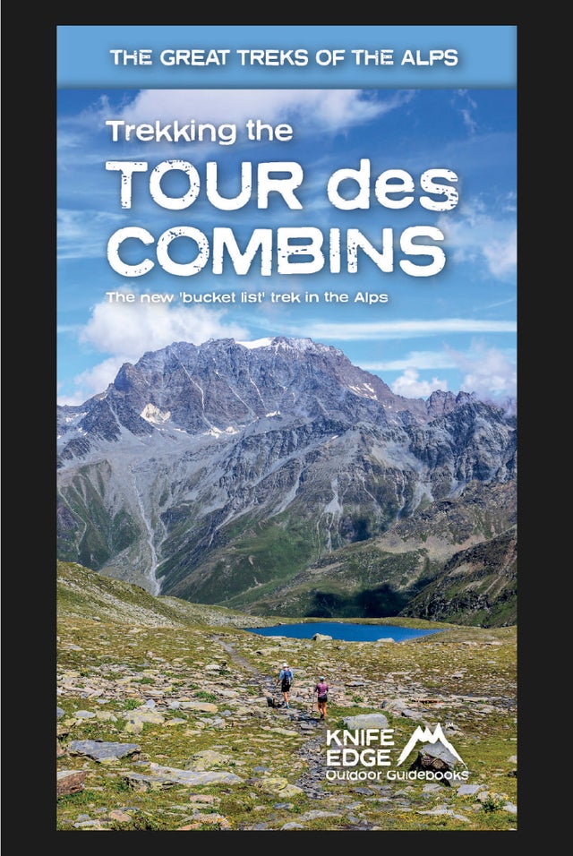
Trekking the Tour des Combins: Two-way Guide: 1:40k mapping; 10 different itineraries
£18.99
The definitive guidebook for the Tour des Combins: the new bucket list trek in the Swiss/Italian Alps. A superb alternative to the more famous Tour du Mont Blanc.
Two-way guide: both clockwise and anti-clockwise routes are described in full.
Real Maps: full mapping inside (1:40,000), made specifically for Knife Edge Outdoor Guidebooks.
All accommodation/campsites are numbered and marked on the maps.
10 different itineraries: schedules of 6, 7, 8 and 9 days for hikers and runners. Includes both clockwise and anti-clockwise itineraries. Difficult calculations of time, distance and altitude gain/loss are done for you.
Also includes:
- Detailed information on equipment and travelling light
- Full accommodation/campsite listings
- Wild camping rules explained
- Everything the trekker needs to know: route, costs, difficulty, weather and more
- Travel to the trail-head
- Essential info for both self-guided and guided trekkers
- Information on plants and wildlife
- Numbered waypoints linking the Real Maps to our clear descriptions
Tour des Combins: Trekking Map
£16.99
Available now!
The best sheet map for the Tour des Combins. Displays the entire route and variants on a single sheet: perfect for planning and navigation.
1:40,000 - larger scale and more detail than any other map.
Made specifically for the Tour des Combins by Knife Edge Outdoor Guidebooks:
- English/French/German map key
- 1:40,000
- Numerous variants
- Includes free GPX downloads for the trail
- GPS compatible
- Tougher than traditional maps: try to tear it!
- More water-resistant than traditional maps
- Lighter than traditional maps
- Huts/accommodation marked on the map
The Tour des Combins is an epic trek in the Swiss and Italian Alps. It traverses some of Europe's wildest mountain terrain. The sublime scenery makes it a worthy alternative to the more famous Tour du Mont Blanc (which is only a stone's throw away).
Hike along the edge of the Corbassière Glacier, one of the longest in Europe. Enjoy snow frosted summits, magnificent valleys and pastures, sparkling azure lakes, carpets of wild flowers, the soothing sound of cow bells and easy to follow paths. Stay in spectacularly situated villages and remote mountain huts. This will be a trip that you will never forget
Tour of the Ecrins National Park (2nd Edition)
£18.99
AVAILABLE NOW
2nd Edition: fully re-written and updated for 2024
Complete guidebook for planning and trekking the GR54 which is arguably the finest trek in the Alps.
- Real maps for each stage: IGN 1:25,000. No need to carry a separate map!
- Unique Itinerary Planner: plan a bespoke itinerary to match your ability and vacation schedule. All difficult calculations of time, distance and altitude gain are done for you
- Everything the trekker needs to know: route descriptions, costs, budget, difficulty, weather, how to get there, equipment and more
- Full accommodation listings: spectacularly situated mountain huts, villages and hamlets
- Full information on camping
- Exciting variants to the main route!
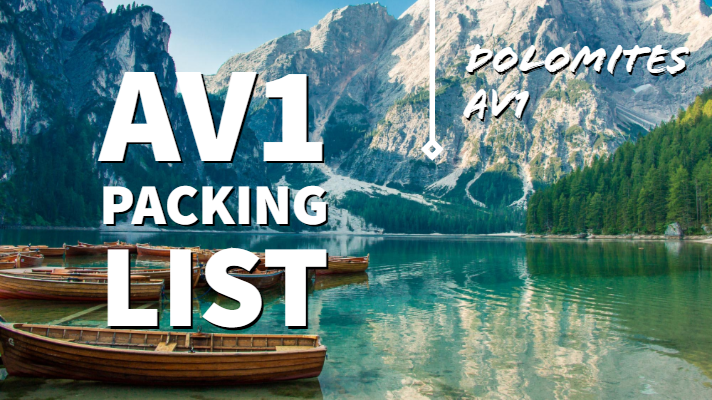
Trekking the Dolomites AV1 (2024 updated version)
£16.99
Fully Updated for 2024!
The only guidebook exclusively for the AV1.
Real maps inside (Tabacco 1:25,000): the finest maps available for the Dolomites.
Everything you need to know to plan and walk Italy's most popular long distance route.
Also includes:
Numbered waypoints linking maps to text
Unique Itinerary Planner: plan a bespoke itinerary to match your ability and vacation schedule. All difficult calculations of time, distance and altitude gain are done for you
7 Proposed Itineraries of between 6 and 11 days
Everything the trekker needs to know to plan the route: route descriptions, costs, budget, difficulty, weather, how to get there, and more
Full accommodation listings: spectacularly situated mountain huts
Section on Camping
Exciting variants to the main route
Information for both self-guided and guided trekkers
Edge to edge colour: the most modern and beautiful guidebooks
Tour du Mont Blanc (2022 updated version)
£16.99
AVAILABLE NOW!
Complete guidebook for planning and trekking the Tour du Mont Blanc, the world's most famous trek
Real maps for each stage: 1:25,000. No need to carry a separate map!
Unique Itinerary Planner: plan a bespoke itinerary to match your ability and vacation schedule. All difficult calculations of time, distance and altitude gain are done for you
Everything the trekker needs to know: route descriptions, costs, budget, difficulty, weather, how to get there, and more
Full accommodation listings: spectacularly situated mountain huts, villages and hamlets
Full section on camping: a complete list of camping locations
10 exciting variants to the main route!
Information for both self-guided and guided trekkers
Walker's Haute Route: Chamonix to Zermatt
£14.99
AVAILABLE NOW!
Real maps for each stage: 1:25,000/1:50,000. No need to carry a separate map!
Also includes:
Real maps for each stage: 1:25,000/1:50,000. No need to carry a separate map!
Also includes:
- Unique Itinerary Planner: plan a bespoke itinerary to match your ability and vacation schedule. All difficult calculations of time, distance and altitude gain are done for you
- Everything the trekker needs to know: route descriptions, costs, budget, difficulty, weather, how to get there, and more
- Full accommodation listings: spectacularly situated mountain huts, villages and hamlets
- Full section on camping: a complete list of camping locations
- Section on Zermatt day walks
- 13 exciting variants to the main route
- Information for both self-guided and guided trekkers
Tour of Monte Rosa: Trekking Map
£16.99
Available now!
The best sheet map for the Tour of Monte Rosa. Displays the entire route and variants on a single sheet: perfect for planning and navigation.
1:40,000 - larger scale and more detail than any other map.
Made specifically for the Tour of Monte Rosa by Knife Edge Outdoor Guidebooks:
- English/French/German map key
- 1:40,000
- Numerous variants
- Includes free GPX downloads for the trail
- GPS compatible
- Tougher than traditional maps: try to tear it!
- More water-resistant than traditional maps
- Lighter than traditional maps
- Huts/accommodation marked on the map
The Tour of Monte Rosa is one of the classic Alpine treks. It leads the trekker on an epic circuit around the Monte Rosa massif. The largest group of 4000m peaks in the Alps is on display: the Weisshorn, the Zinalrothorn, the Dom, the Täschhorn, the Breithorn and the Matterhorn, to name a few.
It is the sister trek to the Walker’s Haute Route and crosses unspoilt and remote mountain terrain: amazing glaciers, snow frosted summits, beautiful valleys and pastures, shimmering lakes, carpets of wild flowers and the soothing sound of cow bells. This trek should be on your hiking bucket list
Trekking Map: Iceland's Laugavegur Trail (& Fimmvörðuháls Trail)
£16.99
Available Now!
Waterproof sheet map for Iceland's Laugavegur Trail (& Fimmvörðuháls Trail): 1:40,000. Includes free GPX downloads for the trails.
The definitive map to Iceland’s two best trails: larger scale and more detail than any other map. Made specifically for the treks by Knife Edge Outdoor Guidebooks.
- Waterproof
- Free GPX downloads
- Tough
- Lightweight
- All huts/campsites are marked
- Information on distances, times and altitude gain/loss between huts/campsites
- Hot springs and fumaroles are marked
The Laugavegur Trail is one of the world's most beautiful and aspirational treks. It leads you into the heart of Iceland’s unique ice-capped, volcanic terrain. Experience spectacular and unusual landscapes, the likes of which you will not find anywhere else on the planet. Impressive volcanic peaks are a constant companion and steam gushes from the ground. This is Iceland at its best and it will be an adventure that you will never forget
Everest Base Camp: Trekking Map (includes Classic EBC, Three Passes & Gokyo Lakes)
£16.99
Available now!
The best sheet map for the Everest treks: Classic EBC, Three Passes & Gokyo Lakes (all clearly colour coded).
1:40,000 - larger scale and more detail than any other Everest map. Perfect for planning and navigation.
Includes walk-in route to Lukla
Made specifically for the Everest treks by Knife Edge Outdoor Guidebooks:
- English/French/German map key
- 1:40,000
- Numerous variants
- Includes free GPX downloads for the trail
- GPS compatible
- Tougher than traditional maps: try to tear me!
- More water-resistant than traditional maps
- Lighter than traditional maps
- Huts/accommodation marked on the map
Trekking Map: Walker’s Haute Route: Chamonix to Zermatt: 1:40,000 mapping; Free GPX downloads
£16.99
Available Now
The best sheet map for the Walker’s Haute Route: Chamonix to Zermatt. This is the only map available that displays the entire route and numerous variants on a single sheet: perfect for planning and navigation.
1:40,000: larger scale and more detail than any other map.
1:10,000: for select areas where navigation is challenging.
Made specifically for the Walker’s Haute Route by Knife Edge Outdoor Guidebooks:
- 1:40,000/1:10,000
- Numerous variants
- Includes free GPX downloads for the trail
- GPS compatible
- Tougher than traditional maps: try to tear me!
- More water-resistant than traditional maps
- Lighter than traditional maps
- Huts/accommodation marked on the map
Walking Chamonix Mont Blanc
£15.99
Available Now!
The 20 hikes in the Chamonix Valley that need to be on your Bucket List. No fillers. Only must-do hikes are included.
► Real IGN Maps inside: 1:25,000
► Detailed information on public transport, including cable cars
► Our secret tips on how to get away from the crowds
► Numbered waypoints linking the Real Maps to our clear descriptions
► Graded routes to suit all abilities
► Everything the hiker needs to know: route descriptions, difficulty, weather, how to get there, and more
► Information on Wildlife and Plants
Our walks have been carefully selected to enable easy access by public transport, including the Chamonix Valley’s incredible cable car network.
Chamonix is the most famous mountain town in the world. It is where mountaineering began.
Its peerless reputation owes everything to the mighty Mont Blanc, the highest peak in Western Europe: our hikes will take you to the finest viewpoints of the mountain and its glaciers.
Walking Brittany
£14.99
Available Now!
32 epic coastal walks Brittany in France
Real IGN Maps inside: 1:25,000.
No ‘fillers’! Only unmissable walks made the cut.
Wild coastline: towering cliffs, remote headlands, forgotten islands and stunning beaches which would not be out of place on a Caribbean island.
32 epic coastal walks Brittany in France
Real IGN Maps inside: 1:25,000.
No ‘fillers’! Only unmissable walks made the cut.
Wild coastline: towering cliffs, remote headlands, forgotten islands and stunning beaches which would not be out of place on a Caribbean island.
