
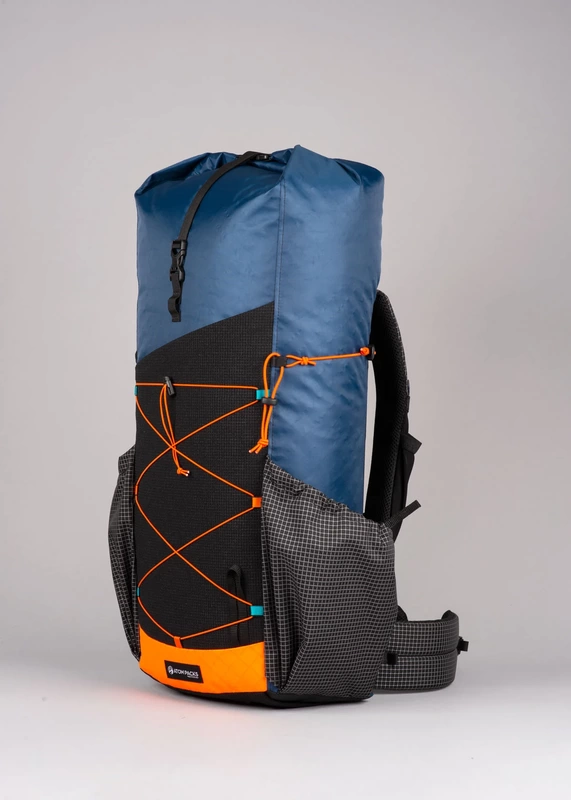
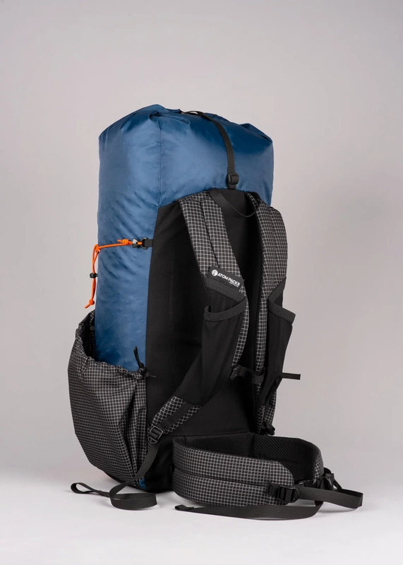
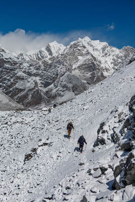
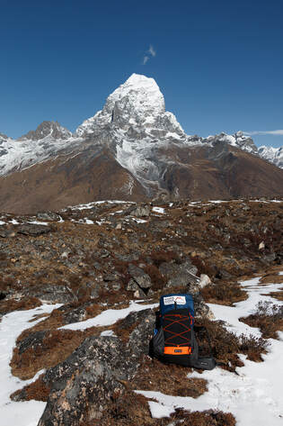
These packs are made to order and you can choose from a variety of bespoke colours, features and sizes to ensure that nobody else will have a pack like yours. If you like ‘em bright you can do this but those who prefer muted colours are catered for too. You can pack the bags with features or you can further lighten them by paring down the external pockets and features. 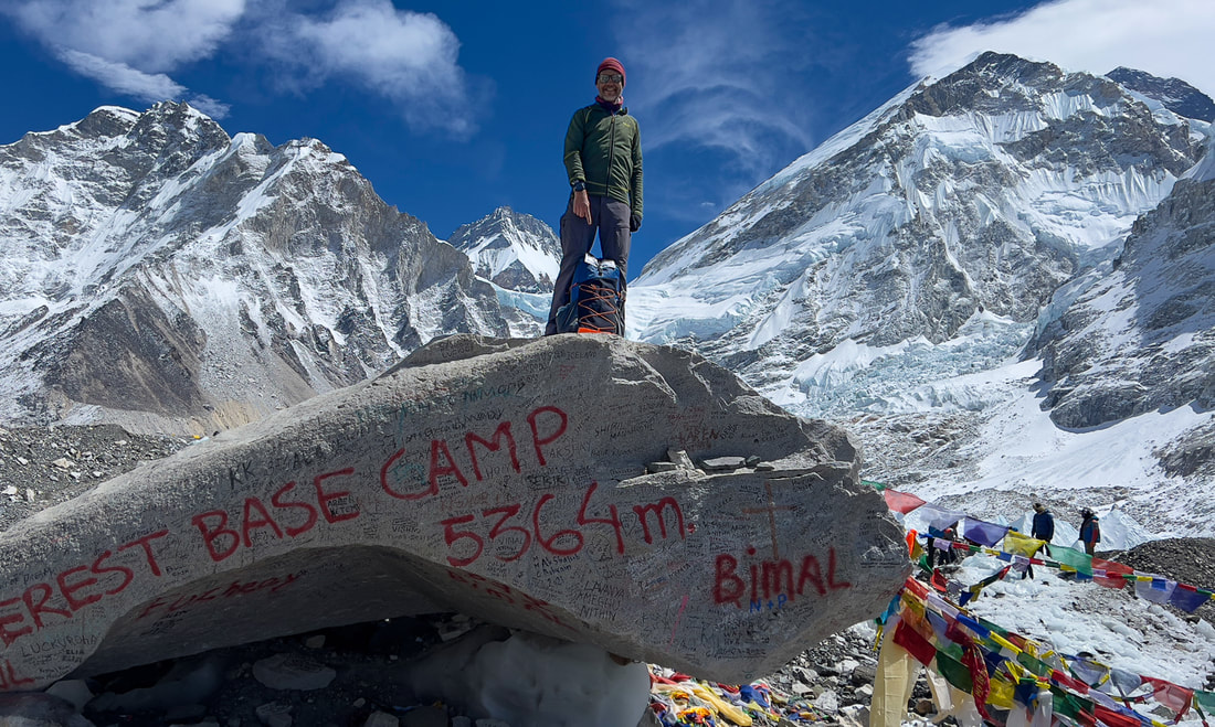 First Impressions When you take it out of the wrapping, the colours of the pack immediately jump out at you. Unless you have ordered muted shades, you will not have seen anything else like it. My pack was the default factory design which is lovely: a classy muted blue married with brightly contrasting orange trimming and chequered grey side-pockets. The next thing you notice is the weight. It feels astonishingly light: barely anything there when you lift it in its empty state. And yet the material feels substantial and strong: much more substantial than the thinner materials used for some other light-weight packs. The main body is made of EPX200 with a DWR finish: it is very light, highly waterproof and feels great. Time will tell but I think that it will last a long time. The straps and buckles are light but well designed and sufficiently padded for most people, I think. The frame is a very interesting design: a carbon hoop fits into the back panel which you can remove if you want (for a 55g weight saving). I used to worry a lot about these carbon frames but over the years, I have never broken one so I am more relaxed now. This one even seems better protected than many by being shielded within the back panel. My pack (two side pockets, medium torso and medium hip belt) weighed in at a mere 656g (23.2 oz): less than half the weight of some light-weight offerings by larger manufacturers. Fitting Because there are so many sizing options to choose from, if you measure yourself accurately, the pack should fit perfectly. Mine certainly did. Definitely one of the most comfortable packs when loaded that I have ever used. It feels snug, secure and comfortable. Some might question the lack of straps at the shoulders but I found that I did not need them: presumably this is one of the benefits of bespoke sizing. Nor can you adjust the height of the straps but you should not need to if you have measured correctly. Remember that these are bespoke packs made specifically for you. Testing
Features I loved the huge, stretchy Dyneema pocket at the front of the pack: I used it for my rain jacket. It seemed very durable, something that can be an issue with other packs. Roll-top closure: European trekkers will take a while to get used to the roll-top closure which is quite unlike traditional packs. However, I have to say that I am a complete convert. It saves weight and is very waterproof. You may miss having a pocket on top but this is easily remedied by adding one or two belt pouches. Side pockets: there are two and they are well-designed, making it easy to reach for a water bottle or other items. They fit Nalgene bottles and the height of them is good, making it easy to access bottles while wearing the pack. If you wish, you can have the pack made without these to save weight. Bottom pocket: the stretchy ‘trash port’ at the bottom of the pack is an excellent innovation. It keeps your trash away from the rest of your kit. We loved it! Shoulder pockets: these are well-designed being bigger than those on many other packs. Customisation Atom Pack’s website has an excellent custom pack builder which leads you seamlessly through the process and there are an incredible number of variables:
Conclusion
Trekking Map: Iceland's Laugavegur Trail (& Fimmvörðuháls Trail)
£16.99
Available Now! Waterproof sheet map for Iceland's Laugavegur Trail (& Fimmvörðuháls Trail): 1:40,000. Includes free GPX downloads for the trails. The definitive map to Iceland’s two best trails: larger scale and more detail than any other map. Made specifically for the treks by Knife Edge Outdoor Guidebooks.
The Laugavegur Trail is one of the world's most beautiful and aspirational treks. It leads you into the heart of Iceland’s unique ice-capped, volcanic terrain. Experience spectacular and unusual landscapes, the likes of which you will not find anywhere else on the planet. Impressive volcanic peaks are a constant companion and steam gushes from the ground. This is Iceland at its best and it will be an adventure that you will never forget Tour of Monte Rosa: Trekking Map
£16.99
Available now! The best sheet map for the Tour of Monte Rosa. Displays the entire route and variants on a single sheet: perfect for planning and navigation. 1:40,000 - larger scale and more detail than any other map. Made specifically for the Tour of Monte Rosa by Knife Edge Outdoor Guidebooks:
The Tour of Monte Rosa is one of the classic Alpine treks. It leads the trekker on an epic circuit around the Monte Rosa massif. The largest group of 4000m peaks in the Alps is on display: the Weisshorn, the Zinalrothorn, the Dom, the Täschhorn, the Breithorn and the Matterhorn, to name a few. It is the sister trek to the Walker’s Haute Route and crosses unspoilt and remote mountain terrain: amazing glaciers, snow frosted summits, beautiful valleys and pastures, shimmering lakes, carpets of wild flowers and the soothing sound of cow bells. This trek should be on your hiking bucket list Tour des Combins: Trekking Map
£16.99
Available now! The best sheet map for the Tour des Combins. Displays the entire route and variants on a single sheet: perfect for planning and navigation. 1:40,000 - larger scale and more detail than any other map. Made specifically for the Tour des Combins by Knife Edge Outdoor Guidebooks:
The Tour des Combins is an epic trek in the Swiss and Italian Alps. It traverses some of Europe's wildest mountain terrain. The sublime scenery makes it a worthy alternative to the more famous Tour du Mont Blanc (which is only a stone's throw away). Hike along the edge of the Corbassière Glacier, one of the longest in Europe. Enjoy snow frosted summits, magnificent valleys and pastures, sparkling azure lakes, carpets of wild flowers, the soothing sound of cow bells and easy to follow paths. Stay in spectacularly situated villages and remote mountain huts. This will be a trip that you will never forget Everest Base Camp: Trekking Map (includes Classic EBC, Three Passes & Gokyo Lakes)
£16.99
Available now! The best sheet map for the Everest treks: Classic EBC, Three Passes & Gokyo Lakes (all clearly colour coded). 1:40,000 - larger scale and more detail than any other Everest map. Perfect for planning and navigation. Includes walk-in route to Lukla Made specifically for the Everest treks by Knife Edge Outdoor Guidebooks:
Tour du Mont Blanc (2022 updated version)
£16.99
AVAILABLE NOW!
Complete guidebook for planning and trekking the Tour du Mont Blanc, the world's most famous trek Real maps for each stage: 1:25,000. No need to carry a separate map! Unique Itinerary Planner: plan a bespoke itinerary to match your ability and vacation schedule. All difficult calculations of time, distance and altitude gain are done for you Everything the trekker needs to know: route descriptions, costs, budget, difficulty, weather, how to get there, and more Full accommodation listings: spectacularly situated mountain huts, villages and hamlets Full section on camping: a complete list of camping locations 10 exciting variants to the main route! Information for both self-guided and guided trekkers Trekking the West Highland Way: Two-way guide
£16.99
Available Now! The definitive two-way guide to the West Highland Way: both northbound and southbound routes are described in full. Real Maps: Full Ordnance Survey Explorer mapping inside (1:25,000) 17 different itineraries: schedules of 3, 4, 5, 6, 7, 8, 9, 10 and 11 days for hikers and runners. Includes both southbound and northbound itineraries. Difficult calculations of time, distance and altitude gain are done for you. Also includes:
Trekking Map: Walker’s Haute Route: Chamonix to Zermatt: 1:40,000 mapping; Free GPX downloads
£16.99
Available Now
The best sheet map for the Walker’s Haute Route: Chamonix to Zermatt. This is the only map available that displays the entire route and numerous variants on a single sheet: perfect for planning and navigation. 1:40,000: larger scale and more detail than any other map. 1:10,000: for select areas where navigation is challenging. Made specifically for the Walker’s Haute Route by Knife Edge Outdoor Guidebooks:
Trekking the Dolomites AV1 (2024 updated version)
£16.99
Fully Updated for 2024! The only guidebook exclusively for the AV1. Real maps inside (Tabacco 1:25,000): the finest maps available for the Dolomites. Everything you need to know to plan and walk Italy's most popular long distance route. Also includes: Numbered waypoints linking maps to text Unique Itinerary Planner: plan a bespoke itinerary to match your ability and vacation schedule. All difficult calculations of time, distance and altitude gain are done for you 7 Proposed Itineraries of between 6 and 11 days Everything the trekker needs to know to plan the route: route descriptions, costs, budget, difficulty, weather, how to get there, and more Full accommodation listings: spectacularly situated mountain huts Section on Camping Exciting variants to the main route Information for both self-guided and guided trekkers Edge to edge colour: the most modern and beautiful guidebooks Trekking the Corsica GR20
£15.99
Available now! The only two-way guide to the GR20: both northbound and southbound routes are described in full. Real IGN Maps included (1:25,000): no need to carry separate maps. 15 different itineraries: schedules of 9, 10, 11, 12, 13, 14, 15 and 16 days. Includes both northbound and southbound itineraries. Difficult calculations of time, distance and altitude gain are done for you. Also includes:
Trekking Iceland's Laugavegur Trail (& Fimmvörðuháls Trail)
£17.99
Available Now! The definitive two-way guide to Iceland's Laugavegur Trail (& Fimmvörðuháls Trail): both southbound and northbound routes are described in full. Real Maps: full mapping inside (1:40,000), made specifically for the treks by Knife Edge Outdoor Guidebooks. All accommodation/campsites are numbered and marked on the maps. 14 different itineraries: schedules of 2, 3, 4, 5, 6 and 7 days for hikers and runners. Includes both southbound and northbound itineraries. Difficult calculations of time, distance and altitude gain/loss are done for you. Also includes:
Trekking the Mallorca GR221
£16.99
Available Now! The definitive two-way guide to the Mallorca GR221 (the Drystone Way): both northbound and southbound routes are described in full. Real Maps: Full mapping inside (1:25,000) by Editorial Alpina. All accommodation is numbered and marked on the maps. 12 different itineraries: schedules of 7, 8, 9, 10 and 11 days for hikers and runners. Includes both northbound and southbound itineraries. Difficult calculations of time, distance and altitude gain/loss are done for you. Also includes:
Trekking the Hadrian’s Wall Path (2024 Updated Version)
£16.99
Available now! Real OS maps 1:25,000 The definitive two-way guide to the Hadrian’s Wall Path: both eastbound and westbound routes are described in full. 14 different itineraries: schedules of 3, 4, 5, 6, 7, 8 and 9 days for walkers and runners. Includes both northbound and southbound itineraries. Difficult calculations of time, distance and altitude gain are done for you. Also includes:
Hadrian’s Wall was one of the Romans’ most ambitious structures. When completed, it ran for 73 miles between the west and east coasts of Northern England. It crossed the crags and hills of some of Britain’s wildest and most beautiful terrain. The Hadrian’s Wall path is one of England’s official ‘National Trails’. It leads you on an unforgettable journey of discovery along the route of the Wall. Discover the incredible surviving sections of the Wall and its forts, milecastles and turrets.
0 Comments
|
Andrew McCluggageblogs about life on the Knife Edge Archives
January 2024
Categories
All
|
 RSS Feed
|
|
Free UK Delivery
International Delivery also available |

|
Company |
Support |
Follow us©Knife Edge Outdoor Guidebooks 2018
|