
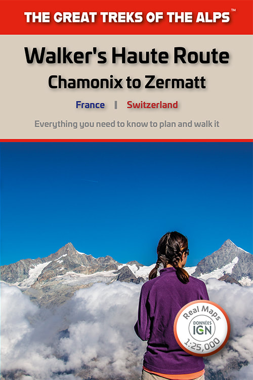
Walker's Haute Route: Chamonix to Zermatt
Real maps for each stage: 1:25,000/1:50,000. No need to carry a separate map!
Also includes:
- Unique Itinerary Planner: plan a bespoke itinerary to match your ability and vacation schedule. All difficult calculations of time, distance and altitude gain are done for you
- Everything the trekker needs to know: route descriptions, costs, budget, difficulty, weather, how to get there, and more
- Full accommodation listings: spectacularly situated mountain huts, villages and hamlets
- Full section on camping: a complete list of camping locations
- Section on Zermatt day walks
- 13 exciting variants to the main route
- Information for both self-guided and guided trekkers
Walker's Haute Route: Chamonix to Zermatt

Walker's Haute Route: Chamonix to Zermatt
Real maps for each stage: 1:25,000/1:50,000. No need to carry a separate map!
Also includes:
- Unique Itinerary Planner: plan a bespoke itinerary to match your ability and vacation schedule. All difficult calculations of time, distance and altitude gain are done for you
- Everything the trekker needs to know: route descriptions, costs, budget, difficulty, weather, how to get there, and more
- Full accommodation listings: spectacularly situated mountain huts, villages and hamlets
- Full section on camping: a complete list of camping locations
- Section on Zermatt day walks
- 13 exciting variants to the main route
- Information for both self-guided and guided trekkers
Trekking Map: Walker’s Haute Route: Chamonix to Zermatt: 1:40,000 mapping; Free GPX downloads
The best sheet map for the Walker’s Haute Route: Chamonix to Zermatt. This is the only map available that displays the entire route and numerous variants on a single sheet: perfect for planning and navigation.
1:40,000: larger scale and more detail than any other map.
1:10,000: for select areas where navigation is challenging.
Made specifically for the Walker’s Haute Route by Knife Edge Outdoor Guidebooks:
- 1:40,000/1:10,000
- Numerous variants
- Includes free GPX downloads for the trail
- GPS compatible
- Tougher than traditional maps: try to tear me!
- More water-resistant than traditional maps
- Lighter than traditional maps
- Huts/accommodation marked on the map
Tour du Mont Blanc (2022 updated version)
Complete guidebook for planning and trekking the Tour du Mont Blanc, the world's most famous trek
Real maps for each stage: 1:25,000. No need to carry a separate map!
Unique Itinerary Planner: plan a bespoke itinerary to match your ability and vacation schedule. All difficult calculations of time, distance and altitude gain are done for you
Everything the trekker needs to know: route descriptions, costs, budget, difficulty, weather, how to get there, and more
Full accommodation listings: spectacularly situated mountain huts, villages and hamlets
Full section on camping: a complete list of camping locations
10 exciting variants to the main route!
Information for both self-guided and guided trekkers
Trekking Iceland's Laugavegur Trail (& Fimmvörðuháls Trail)
Available Now!
The definitive two-way guide to Iceland's Laugavegur Trail (& Fimmvörðuháls Trail): both southbound and northbound routes are described in full.
Real Maps: full mapping inside (1:40,000), made specifically for the treks by Knife Edge Outdoor Guidebooks. All accommodation/campsites are numbered and marked on the maps.
14 different itineraries: schedules of 2, 3, 4, 5, 6 and 7 days for hikers and runners. Includes both southbound and northbound itineraries. Difficult calculations of time, distance and altitude gain/loss are done for you.
Also includes:
- Detailed information on equipment and travelling light
- Full accommodation/campsite listings
- Everything the trekker needs to know: route, costs, difficulty, weather and more
- Travel to the trail-head
- Essential info for both self-guided and guided trekkers
- Information on the volcanic sights along the route
- Information on plants and wildlife
- History of Iceland
- Numbered waypoints linking the Real Maps to our clear descriptions
Walking Chamonix Mont Blanc
The 20 hikes in the Chamonix Valley that need to be on your Bucket List. No fillers. Only must-do hikes are included.
► Real IGN Maps inside: 1:25,000
► Detailed information on public transport, including cable cars
► Our secret tips on how to get away from the crowds
► Numbered waypoints linking the Real Maps to our clear descriptions
► Graded routes to suit all abilities
► Everything the hiker needs to know: route descriptions, difficulty, weather, how to get there, and more
► Information on Wildlife and Plants
Our walks have been carefully selected to enable easy access by public transport, including the Chamonix Valley’s incredible cable car network.
Chamonix is the most famous mountain town in the world. It is where mountaineering began.
Its peerless reputation owes everything to the mighty Mont Blanc, the highest peak in Western Europe: our hikes will take you to the finest viewpoints of the mountain and its glaciers.
Trekking the Dolomites AV1 (2024 updated version)
Fully Updated for 2024!
The only guidebook exclusively for the AV1.
Real maps inside (Tabacco 1:25,000): the finest maps available for the Dolomites.
Everything you need to know to plan and walk Italy's most popular long distance route.
Also includes:
Numbered waypoints linking maps to text
Unique Itinerary Planner: plan a bespoke itinerary to match your ability and vacation schedule. All difficult calculations of time, distance and altitude gain are done for you
7 Proposed Itineraries of between 6 and 11 days
Everything the trekker needs to know to plan the route: route descriptions, costs, budget, difficulty, weather, how to get there, and more
Full accommodation listings: spectacularly situated mountain huts
Section on Camping
Exciting variants to the main route
Information for both self-guided and guided trekkers
Edge to edge colour: the most modern and beautiful guidebooks
Trekking Map: Iceland's Laugavegur Trail (& Fimmvörðuháls Trail)
Available Now!
Waterproof sheet map for Iceland's Laugavegur Trail (& Fimmvörðuháls Trail): 1:40,000. Includes free GPX downloads for the trails.
The definitive map to Iceland’s two best trails: larger scale and more detail than any other map. Made specifically for the treks by Knife Edge Outdoor Guidebooks.
- Waterproof
- Free GPX downloads
- Tough
- Lightweight
- All huts/campsites are marked
- Information on distances, times and altitude gain/loss between huts/campsites
- Hot springs and fumaroles are marked
The Laugavegur Trail is one of the world's most beautiful and aspirational treks. It leads you into the heart of Iceland’s unique ice-capped, volcanic terrain. Experience spectacular and unusual landscapes, the likes of which you will not find anywhere else on the planet. Impressive volcanic peaks are a constant companion and steam gushes from the ground. This is Iceland at its best and it will be an adventure that you will never forget
Tour of Monte Rosa: Trekking Map
Available now!
The best sheet map for the Tour of Monte Rosa. Displays the entire route and variants on a single sheet: perfect for planning and navigation.
1:40,000 - larger scale and more detail than any other map.
Made specifically for the Tour of Monte Rosa by Knife Edge Outdoor Guidebooks:
- English/French/German map key
- 1:40,000
- Numerous variants
- Includes free GPX downloads for the trail
- GPS compatible
- Tougher than traditional maps: try to tear it!
- More water-resistant than traditional maps
- Lighter than traditional maps
- Huts/accommodation marked on the map
The Tour of Monte Rosa is one of the classic Alpine treks. It leads the trekker on an epic circuit around the Monte Rosa massif. The largest group of 4000m peaks in the Alps is on display: the Weisshorn, the Zinalrothorn, the Dom, the Täschhorn, the Breithorn and the Matterhorn, to name a few.
It is the sister trek to the Walker’s Haute Route and crosses unspoilt and remote mountain terrain: amazing glaciers, snow frosted summits, beautiful valleys and pastures, shimmering lakes, carpets of wild flowers and the soothing sound of cow bells. This trek should be on your hiking bucket list
Tour des Combins: Trekking Map
Available now!
The best sheet map for the Tour des Combins. Displays the entire route and variants on a single sheet: perfect for planning and navigation.
1:40,000 - larger scale and more detail than any other map.
Made specifically for the Tour des Combins by Knife Edge Outdoor Guidebooks:
- English/French/German map key
- 1:40,000
- Numerous variants
- Includes free GPX downloads for the trail
- GPS compatible
- Tougher than traditional maps: try to tear it!
- More water-resistant than traditional maps
- Lighter than traditional maps
- Huts/accommodation marked on the map
The Tour des Combins is an epic trek in the Swiss and Italian Alps. It traverses some of Europe's wildest mountain terrain. The sublime scenery makes it a worthy alternative to the more famous Tour du Mont Blanc (which is only a stone's throw away).
Hike along the edge of the Corbassière Glacier, one of the longest in Europe. Enjoy snow frosted summits, magnificent valleys and pastures, sparkling azure lakes, carpets of wild flowers, the soothing sound of cow bells and easy to follow paths. Stay in spectacularly situated villages and remote mountain huts. This will be a trip that you will never forget
Everest Base Camp: Trekking Map (includes Classic EBC, Three Passes & Gokyo Lakes)
Available now!
The best sheet map for the Everest treks: Classic EBC, Three Passes & Gokyo Lakes (all clearly colour coded).
1:40,000 - larger scale and more detail than any other Everest map. Perfect for planning and navigation.
Includes walk-in route to Lukla
Made specifically for the Everest treks by Knife Edge Outdoor Guidebooks:
- English/French/German map key
- 1:40,000
- Numerous variants
- Includes free GPX downloads for the trail
- GPS compatible
- Tougher than traditional maps: try to tear me!
- More water-resistant than traditional maps
- Lighter than traditional maps
- Huts/accommodation marked on the map
Trekking the West Highland Way: Two-way guide
Available Now!
The definitive two-way guide to the West Highland Way: both northbound and southbound routes are described in full.
Real Maps: Full Ordnance Survey Explorer mapping inside (1:25,000)
17 different itineraries: schedules of 3, 4, 5, 6, 7, 8, 9, 10 and 11 days for hikers and runners. Includes both southbound and northbound itineraries. Difficult calculations of time, distance and altitude gain are done for you.
Also includes:
- Detailed information on equipment and travelling light
- Everything the trekker needs to know: route, costs, difficulty, weather, travel, and more
- Full accommodation listings: the best inns, B&Bs and hotels
- Detailed section on camping
- Essential info for both self-guided and guided trekkers
- Information on geology, history, plants and wildlife
- Numbered waypoints linking the Real Maps to our clear descriptions
Trekking the Hadrian’s Wall Path (2024 Updated Version)
Available now!
Real OS maps 1:25,000
The definitive two-way guide to the Hadrian’s Wall Path: both eastbound and westbound routes are described in full.
14 different itineraries: schedules of 3, 4, 5, 6, 7, 8 and 9 days for walkers and runners. Includes both northbound and southbound itineraries. Difficult calculations of time, distance and altitude gain are done for you.
Also includes:
- Extraordinary detail on the history and construction of Hadrian’s Wall
- Section on the unmissable forts of Hadrian’s Wall
- Detailed information on equipment and travelling light
- Everything the trekker needs to know: route, costs, difficulty, weather, travel, and more
- Full accommodation listings: the best inns, B&Bs and hotels
- Information for both self-guided and guided trekkers
- Numbered waypoints linking the Real Maps to our clear descriptions
Hadrian’s Wall was one of the Romans’ most ambitious structures. When completed, it ran for 73 miles between the west and east coasts of Northern England. It crossed the crags and hills of some of Britain’s wildest and most beautiful terrain.
The Hadrian’s Wall path is one of England’s official ‘National Trails’. It leads you on an unforgettable journey of discovery along the route of the Wall. Discover the incredible surviving sections of the Wall and its forts, milecastles and turrets.
