|
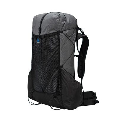
As an outdoor writer and photographer, I spend a lot of time on the trail. Long days with a fully-laden pack is part of my job so I am constantly looking for products which help me lighten the load, without a reduction in performance. Often one of the heaviest things a backpacker carries is the backpack itself and the differences in weights between products can be large. The very lightest packs are light because they incorporate the lightest products available and these are pared down to the bare minimum. Very light materials tend to be very thin. And very thin material is often not very durable.
First Impressions
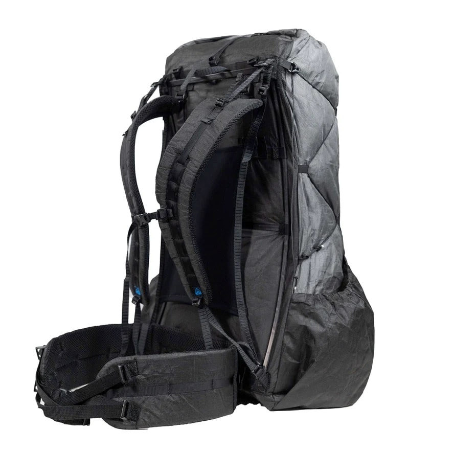
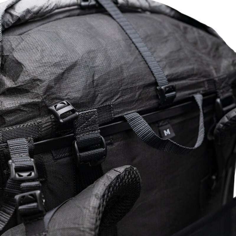
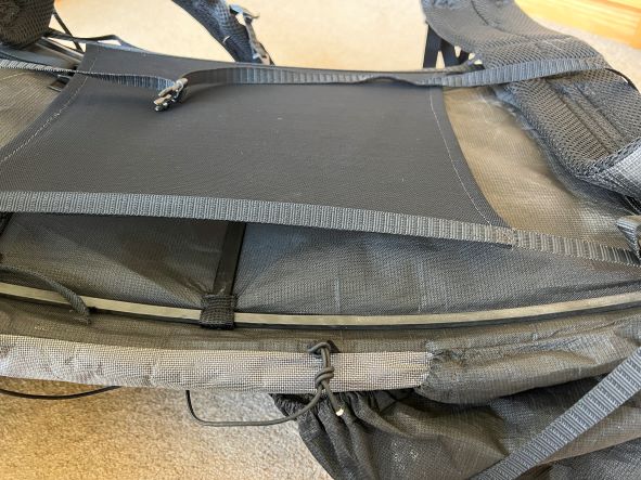
FittingI found that fitting the Arc Haul was easier than fitting the Arc Blast because the frame has been pre-tensioned. There is a good video on Zpacks’ website which clearly shows you how to adjust the straps, etc. Once fitted properly, the pack feels snug, secure and comfortable. There are few manufacturers which give such good guidance on fitting. I am 183cm tall and I chose the medium size: apparently almost nobody goes for the large. It fitted me well but only just. I think that anybody slightly taller than me might find the medium to be too small. One minor observation: I have both the Arc Haul and Arc Blast in the same sizes and I found the Arc Haul to be ever so slightly smaller than the Arc Blast. With the Arc Haul, I was at the very limits of the size band but with the Arc Blast I had a tiny margin to play with. Testing
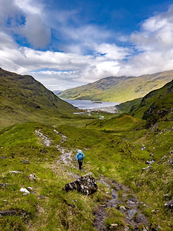
Water-proofing: I tested the pack over 17 days in the wettest part of a very wet country and I found that the Ultra 200 material is very waterproof. I noticed no difference in this regard from the Arc Blast which also performs amazingly. There are a few places where a small amount of water does get in but this is a minor gripe as the pack scores far better than its competitors in this regard. I would still carry a dry-bag though on longer trips but that is no issue as good ones weigh a mere 20g. Features
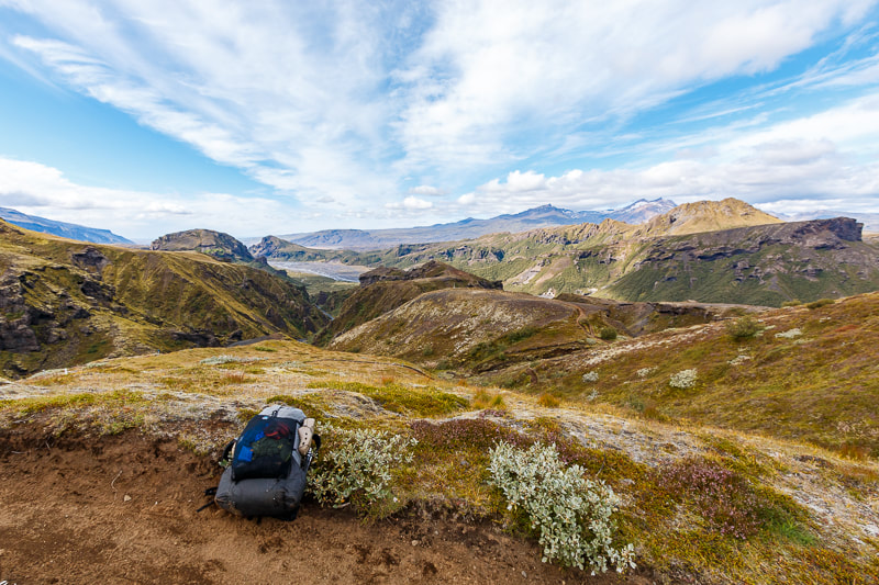
Roll-top closure: European trekkers will take a while to get used to the roll-top closure which is quite unlike traditional packs. However, I have to say that I am a complete convert. It saves weight and is very waterproof. You may miss having a pocket on top but this is easily remedied by adding one or two of Zpacks’ excellent belt pouches. Side pockets: there are two and they are well-designed, making it easy to reach for a water bottle or other items. They fit Nalgene bottles but I would prefer them to be ever so slightly bigger but that is a minor gripe. ConclusionAs well as Scotland’s Cape Wrath Trail, I have also now carried the pack for many weeks in the tough and wet environment of Iceland. The Arc Haul Ultra 60L has now replaced the Arc Blast 55L as my ‘go-to’ pack for long-distance treks. It is only 18g heavier than the current version of the Arc Blast yet it is 5L bigger, with tougher outer material and frame. In fact, it is almost unbelievably light. Yet I found it to be stable, durable and very comfortable. Unlike most other packs, it is almost completely waterproof. Despite the lightweight construction, it performed extremely well. At $399 it is not cheap but if you like to travel ultralight then it is a price worth paying. Andrew McCluggage is an outdoor writer and photographer. He is also the CEO of Knife Edge Outdoor Guidebooks. He has written many books for walking and trekking including The Tour du Mont Blanc, Trekking the Dolomites AV1, Trekking the Corsica GR20, Trekking the West Highland Way, Trekking the Hadrian’s Wall Path, Trekking the Coast to Coast Path and The Haute Route: Chamonix to Zermatt. His latest book is Trekking the Mallorca GR221. Follow Andrew on Facebook and Instagram: @knifeedgeoutdoor Trekking the Corsica GR20
£15.99
Available now! The only two-way guide to the GR20: both northbound and southbound routes are described in full. Real IGN Maps included (1:25,000): no need to carry separate maps. 15 different itineraries: schedules of 9, 10, 11, 12, 13, 14, 15 and 16 days. Includes both northbound and southbound itineraries. Difficult calculations of time, distance and altitude gain are done for you. Also includes:
Trekking the Mallorca GR221
£16.99
Available Now! The definitive two-way guide to the Mallorca GR221 (the Drystone Way): both northbound and southbound routes are described in full. Real Maps: Full mapping inside (1:25,000) by Editorial Alpina. All accommodation is numbered and marked on the maps. 12 different itineraries: schedules of 7, 8, 9, 10 and 11 days for hikers and runners. Includes both northbound and southbound itineraries. Difficult calculations of time, distance and altitude gain/loss are done for you. Also includes:
Trekking Iceland's Laugavegur Trail (& Fimmvörðuháls Trail)
£17.99
Available Now! The definitive two-way guide to Iceland's Laugavegur Trail (& Fimmvörðuháls Trail): both southbound and northbound routes are described in full. Real Maps: full mapping inside (1:40,000), made specifically for the treks by Knife Edge Outdoor Guidebooks. All accommodation/campsites are numbered and marked on the maps. 14 different itineraries: schedules of 2, 3, 4, 5, 6 and 7 days for hikers and runners. Includes both southbound and northbound itineraries. Difficult calculations of time, distance and altitude gain/loss are done for you. Also includes:
Trekking Map: Iceland's Laugavegur Trail (& Fimmvörðuháls Trail)
£16.99
Available Now! Waterproof sheet map for Iceland's Laugavegur Trail (& Fimmvörðuháls Trail): 1:40,000. Includes free GPX downloads for the trails. The definitive map to Iceland’s two best trails: larger scale and more detail than any other map. Made specifically for the treks by Knife Edge Outdoor Guidebooks.
The Laugavegur Trail is one of the world's most beautiful and aspirational treks. It leads you into the heart of Iceland’s unique ice-capped, volcanic terrain. Experience spectacular and unusual landscapes, the likes of which you will not find anywhere else on the planet. Impressive volcanic peaks are a constant companion and steam gushes from the ground. This is Iceland at its best and it will be an adventure that you will never forget Everest Base Camp: Trekking Map (includes Classic EBC, Three Passes & Gokyo Lakes)
£16.99
Available now! The best sheet map for the Everest treks: Classic EBC, Three Passes & Gokyo Lakes (all clearly colour coded). 1:40,000 - larger scale and more detail than any other Everest map. Perfect for planning and navigation. Includes walk-in route to Lukla Made specifically for the Everest treks by Knife Edge Outdoor Guidebooks:
Tour du Mont Blanc (2022 updated version)
£16.99
AVAILABLE NOW!
Complete guidebook for planning and trekking the Tour du Mont Blanc, the world's most famous trek Real maps for each stage: 1:25,000. No need to carry a separate map! Unique Itinerary Planner: plan a bespoke itinerary to match your ability and vacation schedule. All difficult calculations of time, distance and altitude gain are done for you Everything the trekker needs to know: route descriptions, costs, budget, difficulty, weather, how to get there, and more Full accommodation listings: spectacularly situated mountain huts, villages and hamlets Full section on camping: a complete list of camping locations 10 exciting variants to the main route! Information for both self-guided and guided trekkers Trekking the Dolomites AV1 (2024 updated version)
£16.99
Fully Updated for 2024! The only guidebook exclusively for the AV1. Real maps inside (Tabacco 1:25,000): the finest maps available for the Dolomites. Everything you need to know to plan and walk Italy's most popular long distance route. Also includes: Numbered waypoints linking maps to text Unique Itinerary Planner: plan a bespoke itinerary to match your ability and vacation schedule. All difficult calculations of time, distance and altitude gain are done for you 7 Proposed Itineraries of between 6 and 11 days Everything the trekker needs to know to plan the route: route descriptions, costs, budget, difficulty, weather, how to get there, and more Full accommodation listings: spectacularly situated mountain huts Section on Camping Exciting variants to the main route Information for both self-guided and guided trekkers Edge to edge colour: the most modern and beautiful guidebooks Trekking the West Highland Way: Two-way guide
£16.99
Available Now! The definitive two-way guide to the West Highland Way: both northbound and southbound routes are described in full. Real Maps: Full Ordnance Survey Explorer mapping inside (1:25,000) 17 different itineraries: schedules of 3, 4, 5, 6, 7, 8, 9, 10 and 11 days for hikers and runners. Includes both southbound and northbound itineraries. Difficult calculations of time, distance and altitude gain are done for you. Also includes:
Trekking the Hadrian’s Wall Path (2024 Updated Version)
£16.99
Available now! Real OS maps 1:25,000 The definitive two-way guide to the Hadrian’s Wall Path: both eastbound and westbound routes are described in full. 14 different itineraries: schedules of 3, 4, 5, 6, 7, 8 and 9 days for walkers and runners. Includes both northbound and southbound itineraries. Difficult calculations of time, distance and altitude gain are done for you. Also includes:
Hadrian’s Wall was one of the Romans’ most ambitious structures. When completed, it ran for 73 miles between the west and east coasts of Northern England. It crossed the crags and hills of some of Britain’s wildest and most beautiful terrain. The Hadrian’s Wall path is one of England’s official ‘National Trails’. It leads you on an unforgettable journey of discovery along the route of the Wall. Discover the incredible surviving sections of the Wall and its forts, milecastles and turrets. Trekking the South Downs Way
£14.99
Available Now!
The definitive two-way guide to the South Downs Way: both westbound and eastbound routes are described in full. Real Maps: Full Ordnance Survey Explorer mapping inside (1:25,000) 18 different itineraries: schedules of 4, 5, 6, 7, 8, 9, 10, 11 and 12 days for walkers and runners. Includes both westbound and eastbound itineraries. Difficult calculations of time, distance and altitude gain are done for you. Also includes:
The South Downs Way leads you on an unforgettable journey of discovery through the magnificent chalk hills of Sussex and Hampshire. It travels the length of the South Downs National Park across wonderful hills and meadows bedecked with wild-flowers, through endless fields of shimmering golden corn and along the edge of the epic white cliffs of the Seven Sisters and Beachy Head. It is one of England’s official ‘National Trails’ and is an unforgettable experience Trekking the Cotswold Way
£15.99
Available Now! The definitive two-way guide to the Cotswold Way: both southbound and northbound routes are described in full. Real Maps: Full Ordnance Survey mapping inside (1:25,000). All accommodation is numbered and marked on the maps. 18 different itineraries: schedules of 4, 5, 6, 7, 8, 9, 10, 11 and 12 days for hikers and runners. Includes both southbound and northbound itineraries. Difficult calculations of time, distance and altitude gain/loss are done for you. Also includes:
Trekking the Coast to Coast Path
£16.99
Available Now! The definitive two-way guide to the Coast to Coast Path: both eastbound and westbound routes are described in full. Real Maps: Full Ordnance Survey mapping inside (1:25,000). All accommodation is numbered and marked on the maps. 19 different itineraries: schedules of 11, 12, 13, 14, 15, 16, 17, 18 and 19 days for hikers and runners. Includes both eastbound and westbound itineraries. Difficult calculations of time, distance and altitude gain/loss are done for you. Also includes:
0 Comments
Your comment will be posted after it is approved.
Leave a Reply. |
Andrew McCluggageblogs about life on the Knife Edge Archives
January 2024
Categories
All
|
|
|
Free UK Delivery
International Delivery also available |
|
|
Company |
Support |
Follow us©Knife Edge Outdoor Guidebooks 2018
|

 RSS Feed
