
What is the GR20?
The GR20 is a linear trek which travels the long spine of the rugged and spectacular mountain range on the Mediterranean island of Corsica. It is the stuff of legend and is, without a doubt, one of the wildest and toughest treks in Europe. Most seasoned trekkers have it on their list of the world’s best treks. Those who have walked it never forget it, forever regaling others with tales of their exploits. Few other treks provide so many talking points . And few other treks instil in the walker such a complicated mixture of emotions: joy, exhilaration and awe coexist with respect, fear and intimidation. It is fair to say that to complete the GR20 is to achieve something worthwhile and unforgettable. Something that required you to dig deep within yourself. Something to be truly proud of.

Basic Statistics200km long with 12,700 metres of ascent. The highest point is 2607m.
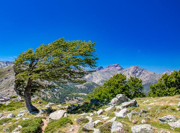
What is so special about the GR20?It is WILD. Unlike many other European treks, the GR20 stays well away from civilisation, crossing rural roads only a handful of times. Over 200km, only two tiny villages are entered: the GR20 is a true wilderness experience.
And it is SPECTACULAR. The mountain scenery on the route is exquisite: jagged rocky peaks, sheer cliffs, lofty mountain passes, shimmering cobalt lakes and glorious green pastures bedecked with wild-flowers. Nothing can prepare you for the splendour that you will experience. Those who walk the GR20 witness scenery accessible to very few. The camaraderie with other trekkers (from all around the world) is wonderful. And the feeling of satisfaction on completion of the trek is something to be savoured. How long does it take?Most trek the route in 9 to 16 days. But some fit and experienced walkers do it quicker. Our guidebook sets out 15 different itineraries of 16, 15, 14 , 13, 12, 11, 10 and 9 days. It really is up to you and your fitness level.
|
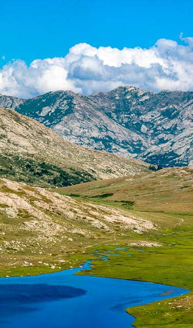
Lac de Nino is a highlight of the GR20
|
How hard is the GR20
Notwithstanding the challenges, the GR20 is walked by an estimated 20,000 to 30,000 people each year. It is therefore an achievable endeavour. However, it is a multi-day trek with significant distances to travel, and metres to climb, each day.
On paper, the statistics are comparable with many alpine treks such as the Tour du Mont Blanc and the Walker’s Haute Route. However, in practice the GR20 is harder. In fact, many consider it to be one of the hardest treks in Europe. In France, it has a legendary reputation and is often viewed as a kind of ‘rite of passage’. Even the French Foreign Legion train on the route.
A good level of fitness is therefore required to complete the GR20 which is physically and mentally challenging. A sure foot and a head for heights are also essential. Although not absolutely necessary, previous experience of backpacking and camping will help. Furthermore, it is advisable to train well for the trek: there is no substitute for training walks, carrying a pack.
The rocky terrain is challenging and there is some scrambling too (so you will frequently need to use your hands). Consequently, you will travel more slowly than normal, covering smaller distances than you are used to. Fortunately, the challenge is mitigated slightly by the fact that much of the rock is granite which normally provides excellent grip. The excellent waymarking helps too. Many sections of the route are very exposed too with steep drops. And the weather in summer is very hot.
What are the trails like?The route is often rocky. Large sections of the trek have no path and frequently, you must cross long sections of boulders. For this reason, the route has been extremely well marked. In fact, it is possibly the best-waymarked trail in the world: most of the red/white markings have been carefully placed to be in the line of sight of the previous one. In good conditions therefore navigation is usually straightforward.
When there is a path, it is often rocky and tiring to walk on (particularly in the N sections). Paths improve on the S half of the route but there are still some difficult parts. There is much scrambling (particularly on the N half) and you will frequently need to use your hands. Sometimes cables or railings have been bolted into the rocks to assist you on particularly difficult or exposed sections. |
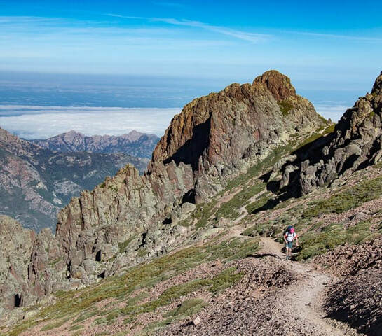
Rising above the clouds on the GR20
|
Should I go on an guided trip or walk independently?
The answer is a personal one, depending upon your own particular circumstances and requirements. For many, the decision to organise the trek themselves, and to walk independently, can be almost life-changing, opening the door for other challenges in the future. There is much satisfaction to be gained in planning and navigating a trek yourself and the sense of achievement on completion is to be savoured.
However, the independent trekker usually carries his own pack and is responsible for all daily decisions such as pacing; which way to go at junctions; when to stock up with food and water; and choice of route in bad weather. For some, this will be too great a burden on top of the physical effort required simply to walk the route. For those walkers, a guided group is a great solution: the tour company typically organises food, accommodation and (if possible) transfer of luggage each night. And the guide makes all the decisions, enabling the walker to concentrate on the walking. There are a number of tour companies operating guided trips on the GR20 but some do not cover the full official route.
Self-guided tours are a popular middle-ground. The tour company books all the accommodation and provides all the advice and information required to complete the trek. Often they will also arrange your food. However, the trekker walks the trail without a guide and normally (but not always) carries his/her own pack.
Some tour companies (guided and self-guided) offer luggage transfers, delivering your bags to fixed points along the trail. However, the geography of the GR20 dictates that you will only be able to get your bags delivered to certain overnight stops which have road access: you would have to carry your gear yourself for the other overnight stops.
Many confident trekkers (who would be perfectly capable of walking independently) book a self-guided trip simply to avail of the accommodation booking service. By booking a self-guided tour, the stress and hassle are alleviated, albeit at a price.
When to go?Normally you can tackle the GR20 from June to mid-October. Between mid-June and mid-September, refuges are likely to be full so book early if you want a dormitory bed or fixed tent.
June is probably the best time to trek the GR20, as soon as the snow has cleared from the paths. The days are long and the weather is normally warm and sunny: temperatures increase as the month progresses. The peaks are very photogenic, often still frosted with snow. Summer haze has not yet arrived so visibility is generally excellent with wide-ranging views. The summer thunderstorms, for which Corsica is famous, are less likely. And there are carpets of spring wild-flowers. Of course, there is occasionally rain at this time of year but this usually lessens as the month progresses. At the start of the month, there are fewer trekkers and the mountains are more peaceful. However, by the middle of the month, the trek is busy. The refuges are staffed from the end of May. Most private bergeries will open during the first half of the month. Some public transport may not be available early in the month: check in advance. In some years, snow lies on high passes until mid-June, making short sections of the GR20 difficult and/or dangerous: in such conditions, crampons and/or an ice-axe might be helpful. July/August is the main summer season. All refuges and private bergeries are fully staffed and all public transport should operate. It can be very hot, sometimes reaching well over 30°C. Mornings often start with clear, sunny skies and heat up as the sun gains height. If there is to be cloud or haze, often this will arrive in the afternoon when thunderstorms are more likely. This is the busiest time on the GR20 and it is advisable to make bookings for refuges and fixed tents well in advance. Do not turn up without a reservation and expect to find a bed. |
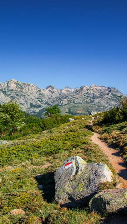
The excellent waymarking on the GR20
|
September can be a great month for walking as the weather is often more settled than in summer. Skies are usually clear and visibility excellent. Daytime temperatures are normally still warm but evenings get cooler and the days get shorter. Nowadays, with the increased popularity of the GR20, refuges and fixed tents are frequently full to capacity even in September. However, it is still fair to say that the number of trekkers decreases, and bookings become easier, as September progresses. Nevertheless, it is still wise to book in advance. During the month, private bergeries may close for the season and some bus services may cease to operate.
October is the end of the trekking season and is probably the quietest time on the GR20. Sometimes the autumn weather can be magnificent: clear skies and warm sunny days. However, there is a greater chance of rain and the likelihood of snow on the high passes increases as the month progresses. Evenings can be cold with frost at altitude. Normally, staff leave the refuges early in the month but they remain open: you can still sleep in the dormitories but there will be no food available. Private bergeries and many shops will be closed so you will need to carry more food and plan carefully. Many bus routes will have stopped operating. In summary, October trekking is best suited to more experienced trekkers.
October is the end of the trekking season and is probably the quietest time on the GR20. Sometimes the autumn weather can be magnificent: clear skies and warm sunny days. However, there is a greater chance of rain and the likelihood of snow on the high passes increases as the month progresses. Evenings can be cold with frost at altitude. Normally, staff leave the refuges early in the month but they remain open: you can still sleep in the dormitories but there will be no food available. Private bergeries and many shops will be closed so you will need to carry more food and plan carefully. Many bus routes will have stopped operating. In summary, October trekking is best suited to more experienced trekkers.
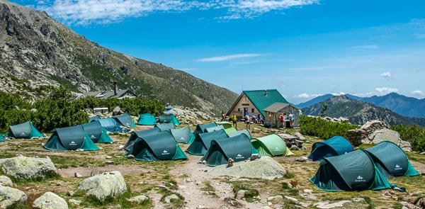
Where do you stay?
On the GR20, you can stay in dormitories or fixed tents at refuges. Alternatively, you can pitch your own tent at the permitted campsites at refuges and private bergeries. On rare occasions, there is a gîte or hotel on the route. In addition, there are sometimes gîtes, hotels or campsites a few hours off-route.
Refuges form the ‘back-bone’ of GR20 accommodation. They are run by the PNRC. There is a refuge (or mountain hut) at the end of almost every stage itineraries. The huts are usually situated in the heart of the mountains where they are accessible only to walkers. Each refuge has a source of drinking water.
In season, the refuges offer drinks, breakfast and simple evening meals. Each refuge also has a small shop where you can buy basic food supplies and fuel: stocks sometimes run out. There will also be a small cooking area where you can prepare your own hot meals: gas cookers, pots/pans, crockery and cutlery are normally provided but the quality and quantity of items varies.
Each refuge normally has a mixed-sex dormitory and fixed tents. Alternatively, you can pitch your own tent nearby. The fixed tents are pitched permanently during the season and can normally accommodate up to 2 people. Toilets and showers are basic and often not very clean.
The majority of trekkers carry their own tents and camp at the designated sites beside refuges and bergeries. The risk of bush-fires is high so wild camping is prohibited: you are only permitted to camp at the designated camp-grounds.
One of the beautifully situated refuges on the Corsica GR20
Do I need to book in advance?
In June, July, August and the first half of September, forward booking is essential if you wish to stay in refuge dormitories or fixed tents. If you are staying in your own tent, no reservation is required: it is first come, first served. On arrival at the refuge/bergerie, you simply select one of the available pitches and go and pay your fee.
How much does it cost to trek the GR20?
No permits are required to hike. So if you walk independently, your only costs should be food and accommodation. A dormitory bed/fixed tent at a refuge, with an evening meal and breakfast costs around €40-45/person. If you are bringing your own tent and/or cooking for yourself, it is cheaper.
Travelling Light
It is fair to say that most trekkers set off carrying equipment which is unnecessary or simply too heavy. You have complete control over what you bring and so you should give equipment choice careful consideration.
A trekkers base weight is the weight of his/her pack, excluding food and water. If you are not carrying your own tent and cooking equipment, it is perfectly possible to get by with a base weight of 6kg (13lb) or less. If you intend to carry camping equipment then, by investing in some modern lightweight gear, you could start the trek with a base weight of 8kg (17lb) or less. Many people are quick to tell you that the lighter the gear, the greater the price but that is not always the case. While it is true that lightweight gear can be expensive, there are also some excellent lightweight products which are great value. Tents, sleeping bags and backpacks are the three heaviest items that you will carry so they offer the biggest opportunities for weight-saving. But do not ignore the smaller items either as the weight can quickly add up.
Pack weight is so important on the GR20 that, if you can afford it, it is sensible to invest some money in lighter gear before you go. The lighter your gear, the more you will enjoy the trek and the better your chance of success. Be ruthless as every ounce counts.
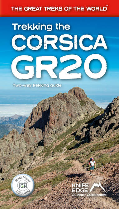
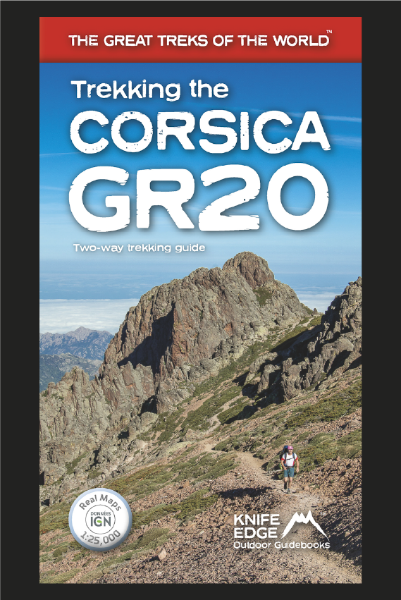
Our amazing new book on the Corsica GR20
|
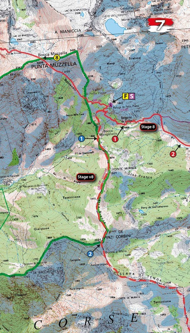
Real IGN Maps are included in our guidebook (1:25,000)
|
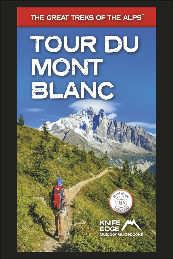
Tour du Mont Blanc (2022 updated version)
£16.99
AVAILABLE NOW!
Complete guidebook for planning and trekking the Tour du Mont Blanc, the world's most famous trek
Real maps for each stage: 1:25,000. No need to carry a separate map!
Unique Itinerary Planner: plan a bespoke itinerary to match your ability and vacation schedule. All difficult calculations of time, distance and altitude gain are done for you
Everything the trekker needs to know: route descriptions, costs, budget, difficulty, weather, how to get there, and more
Full accommodation listings: spectacularly situated mountain huts, villages and hamlets
Full section on camping: a complete list of camping locations
10 exciting variants to the main route!
Information for both self-guided and guided trekkers
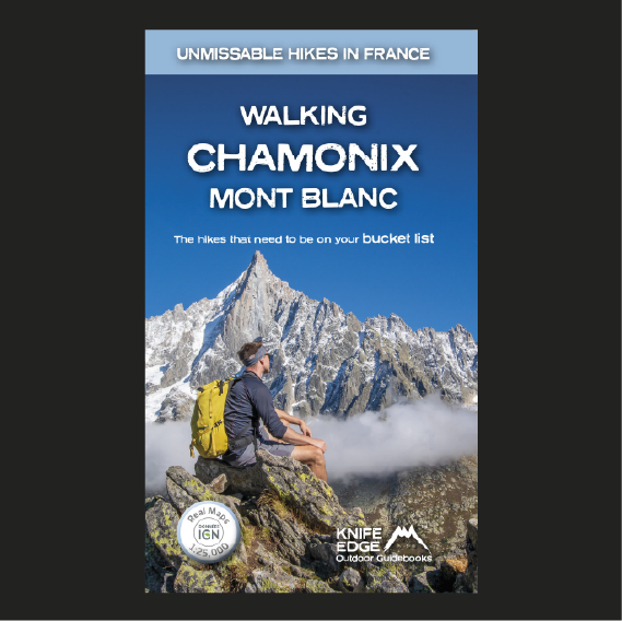
Walking Chamonix Mont Blanc
£15.99
Available Now!
The 20 hikes in the Chamonix Valley that need to be on your Bucket List. No fillers. Only must-do hikes are included.
► Real IGN Maps inside: 1:25,000
► Detailed information on public transport, including cable cars
► Our secret tips on how to get away from the crowds
► Numbered waypoints linking the Real Maps to our clear descriptions
► Graded routes to suit all abilities
► Everything the hiker needs to know: route descriptions, difficulty, weather, how to get there, and more
► Information on Wildlife and Plants
Our walks have been carefully selected to enable easy access by public transport, including the Chamonix Valley’s incredible cable car network.
Chamonix is the most famous mountain town in the world. It is where mountaineering began.
Its peerless reputation owes everything to the mighty Mont Blanc, the highest peak in Western Europe: our hikes will take you to the finest viewpoints of the mountain and its glaciers.
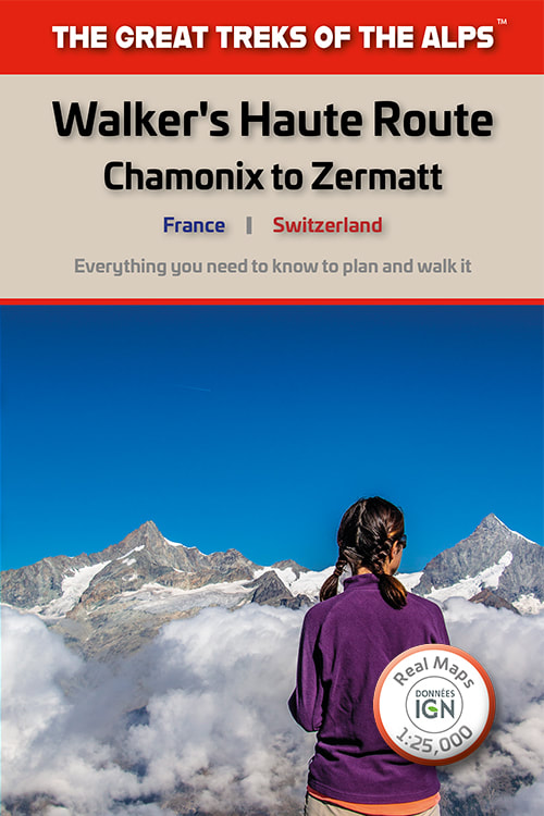
Walker's Haute Route: Chamonix to Zermatt
£14.99
AVAILABLE NOW!
Real maps for each stage: 1:25,000/1:50,000. No need to carry a separate map!
Also includes:
Real maps for each stage: 1:25,000/1:50,000. No need to carry a separate map!
Also includes:
- Unique Itinerary Planner: plan a bespoke itinerary to match your ability and vacation schedule. All difficult calculations of time, distance and altitude gain are done for you
- Everything the trekker needs to know: route descriptions, costs, budget, difficulty, weather, how to get there, and more
- Full accommodation listings: spectacularly situated mountain huts, villages and hamlets
- Full section on camping: a complete list of camping locations
- Section on Zermatt day walks
- 13 exciting variants to the main route
- Information for both self-guided and guided trekkers
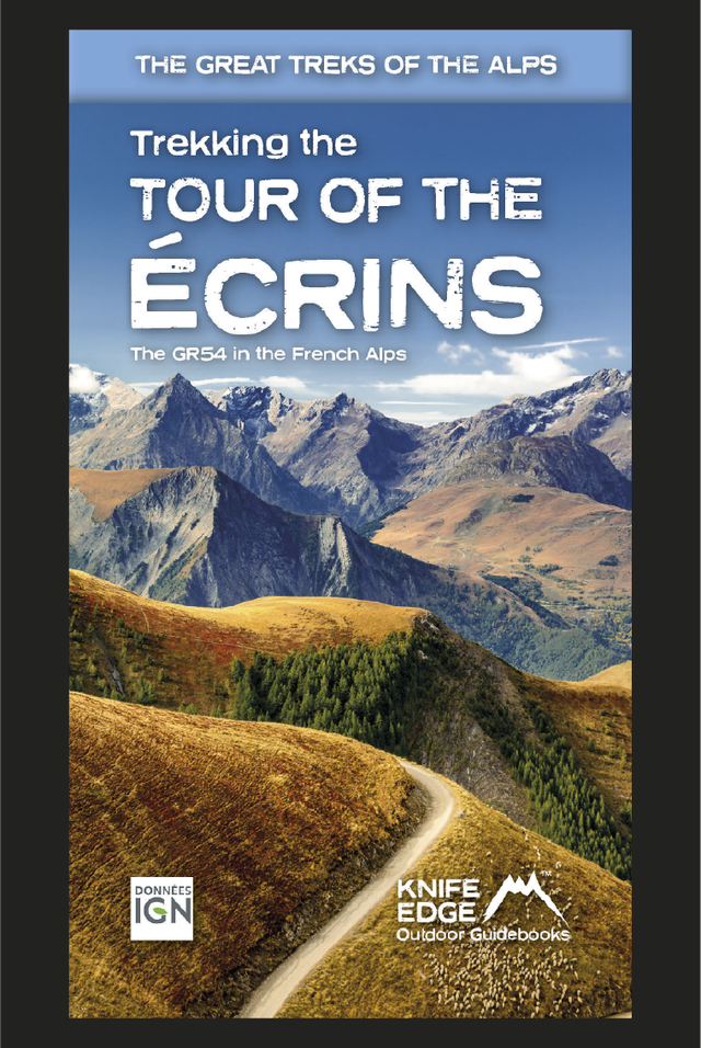
Tour of the Ecrins National Park (2nd Edition)
£18.99
AVAILABLE NOW
2nd Edition: fully re-written and updated for 2024
Complete guidebook for planning and trekking the GR54 which is arguably the finest trek in the Alps.
- Real maps for each stage: IGN 1:25,000. No need to carry a separate map!
- Unique Itinerary Planner: plan a bespoke itinerary to match your ability and vacation schedule. All difficult calculations of time, distance and altitude gain are done for you
- Everything the trekker needs to know: route descriptions, costs, budget, difficulty, weather, how to get there, equipment and more
- Full accommodation listings: spectacularly situated mountain huts, villages and hamlets
- Full information on camping
- Exciting variants to the main route!
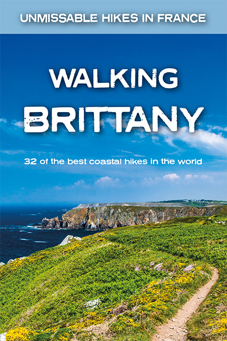
Walking Brittany
£14.99
Available Now!
32 epic coastal walks Brittany in France
Real IGN Maps inside: 1:25,000.
No ‘fillers’! Only unmissable walks made the cut.
Wild coastline: towering cliffs, remote headlands, forgotten islands and stunning beaches which would not be out of place on a Caribbean island.
32 epic coastal walks Brittany in France
Real IGN Maps inside: 1:25,000.
No ‘fillers’! Only unmissable walks made the cut.
Wild coastline: towering cliffs, remote headlands, forgotten islands and stunning beaches which would not be out of place on a Caribbean island.
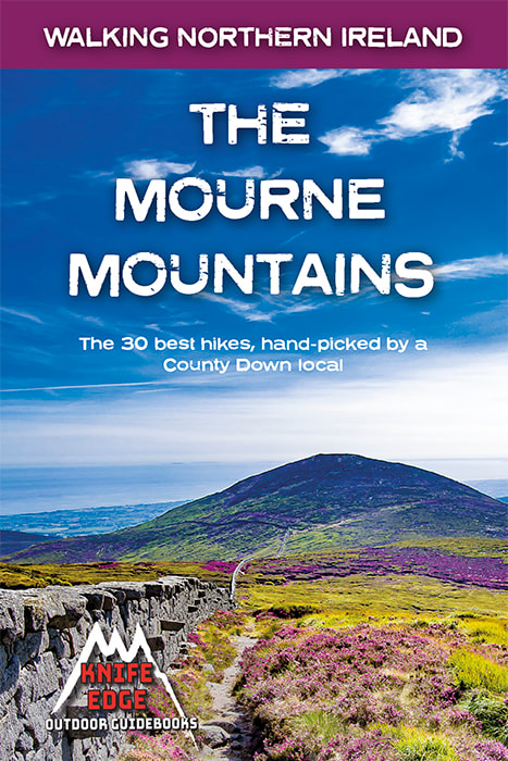
The Mourne Mountains: 30 best hikes
£14.99
Available now!
30 epic walks in Northern Ireland's highest mountains.
The only Mournes guidebook with Real OSNI Maps inside (1:25k): no need to carry separate maps!
The only Mournes guidebook written by a local walker with decades of experience.
Also includes:
▶ Numbered waypoints linking the Real Maps to our clear descriptions
▶ Graded routes to suit all abilities
▶ Everything the hiker needs to know: route descriptions, difficulty, weather, how to get there, and more
▶ 4 different ways to summit Slieve Donard, Northern Ireland's highest peak
▶ The 21 mile Mourne Wall challenge walk
▶ List of Irish place names
▶ Information on Wildlife, Plants & Geology
▶ Game of Thrones film locations
▶ Section on accommodation
