
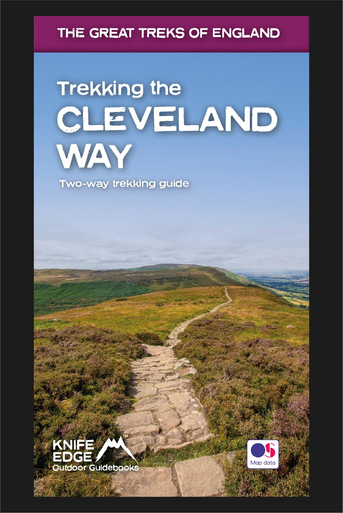
Trekking the Cleveland Way: Two-way guidebook with OS 1:25k maps: 20 different itineraries
Available Now!
The definitive two-way guide to the Cleveland Way, one of England’s epic National Trails: both eastbound and westbound routes are described in full.
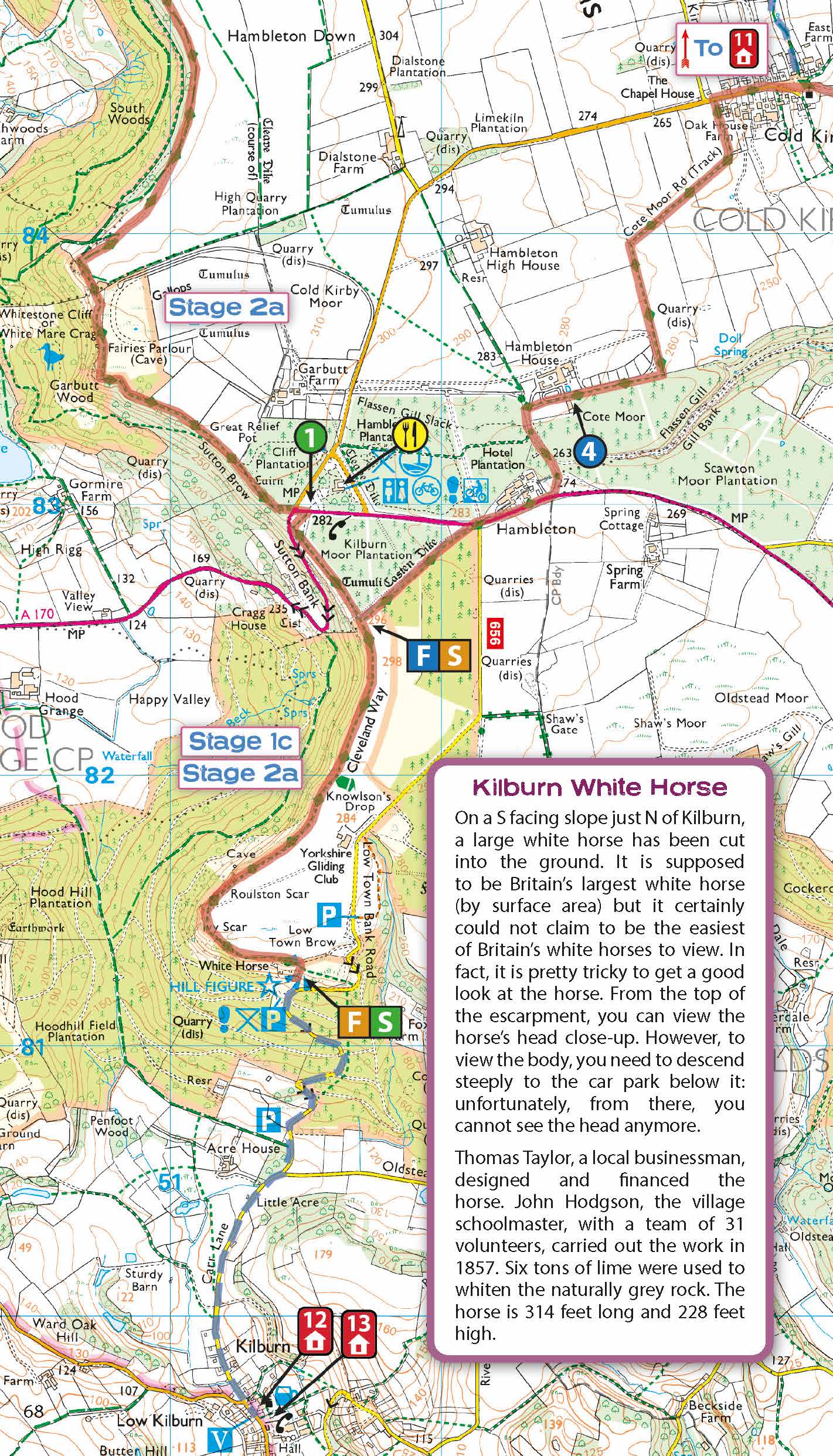
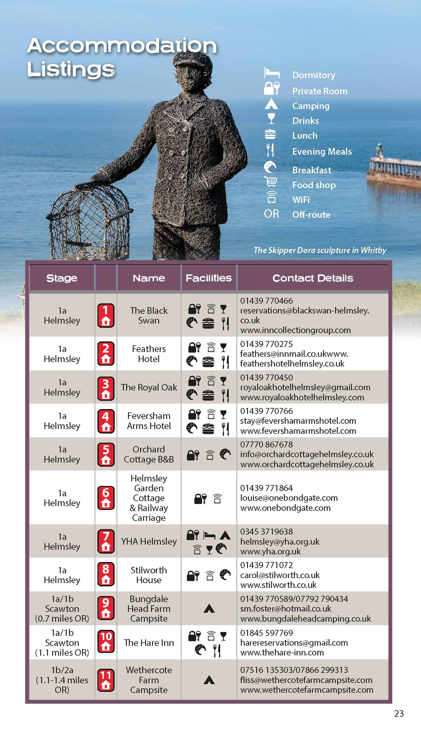
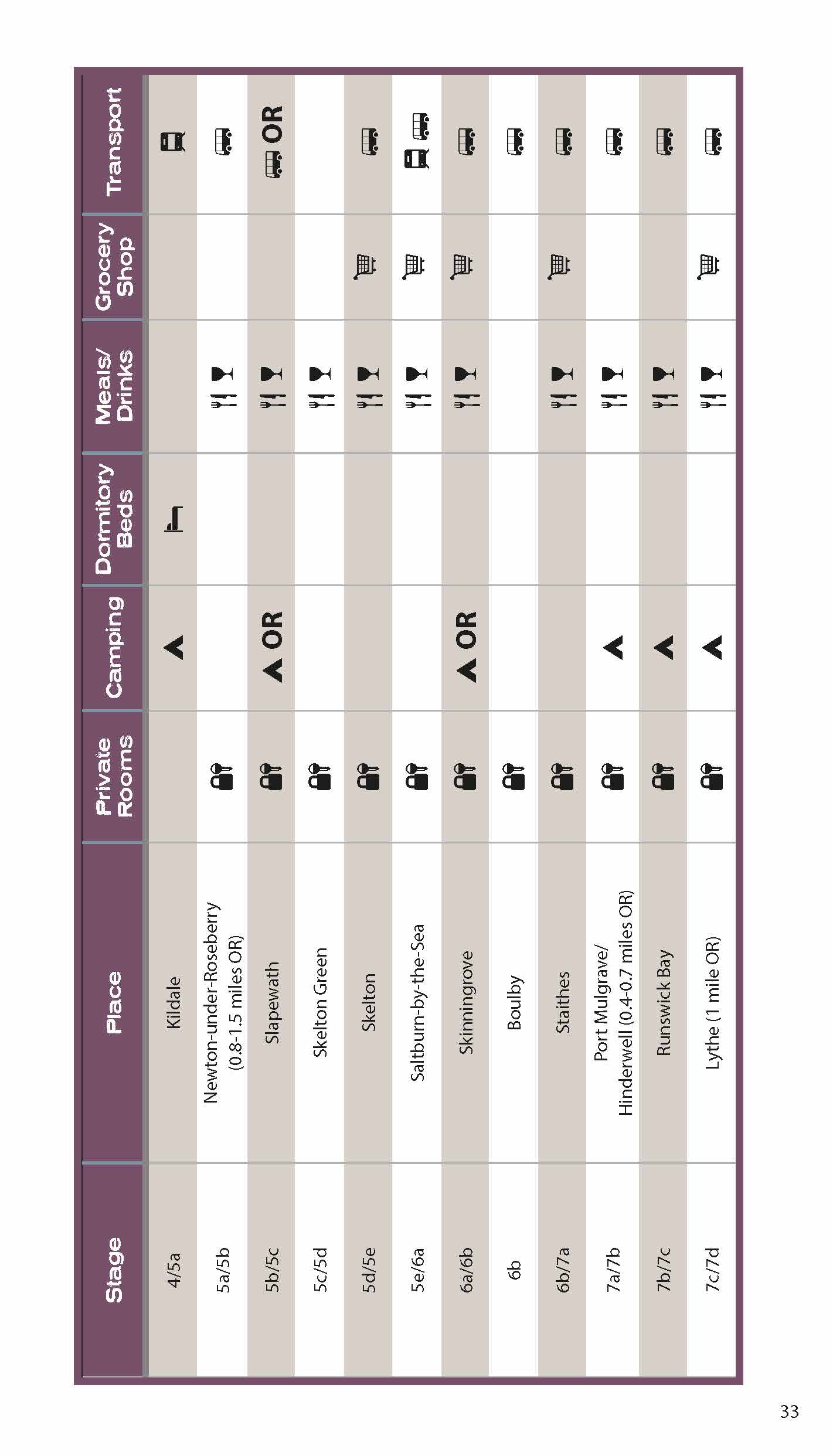
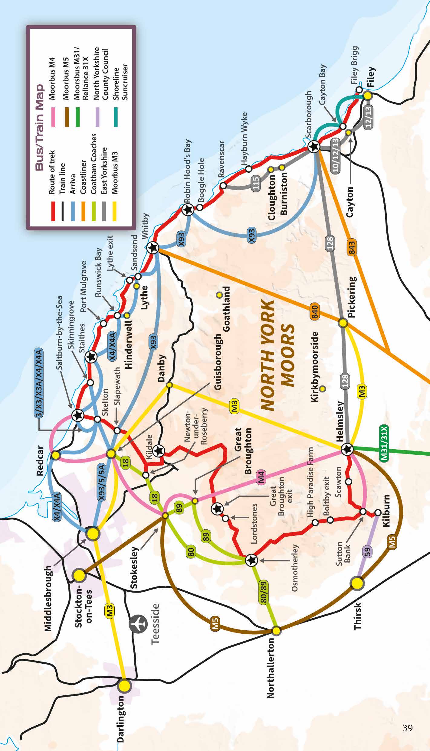
Real Maps: Full Ordnance Survey mapping inside (1:25,000). All accommodation is numbered and marked on the maps.
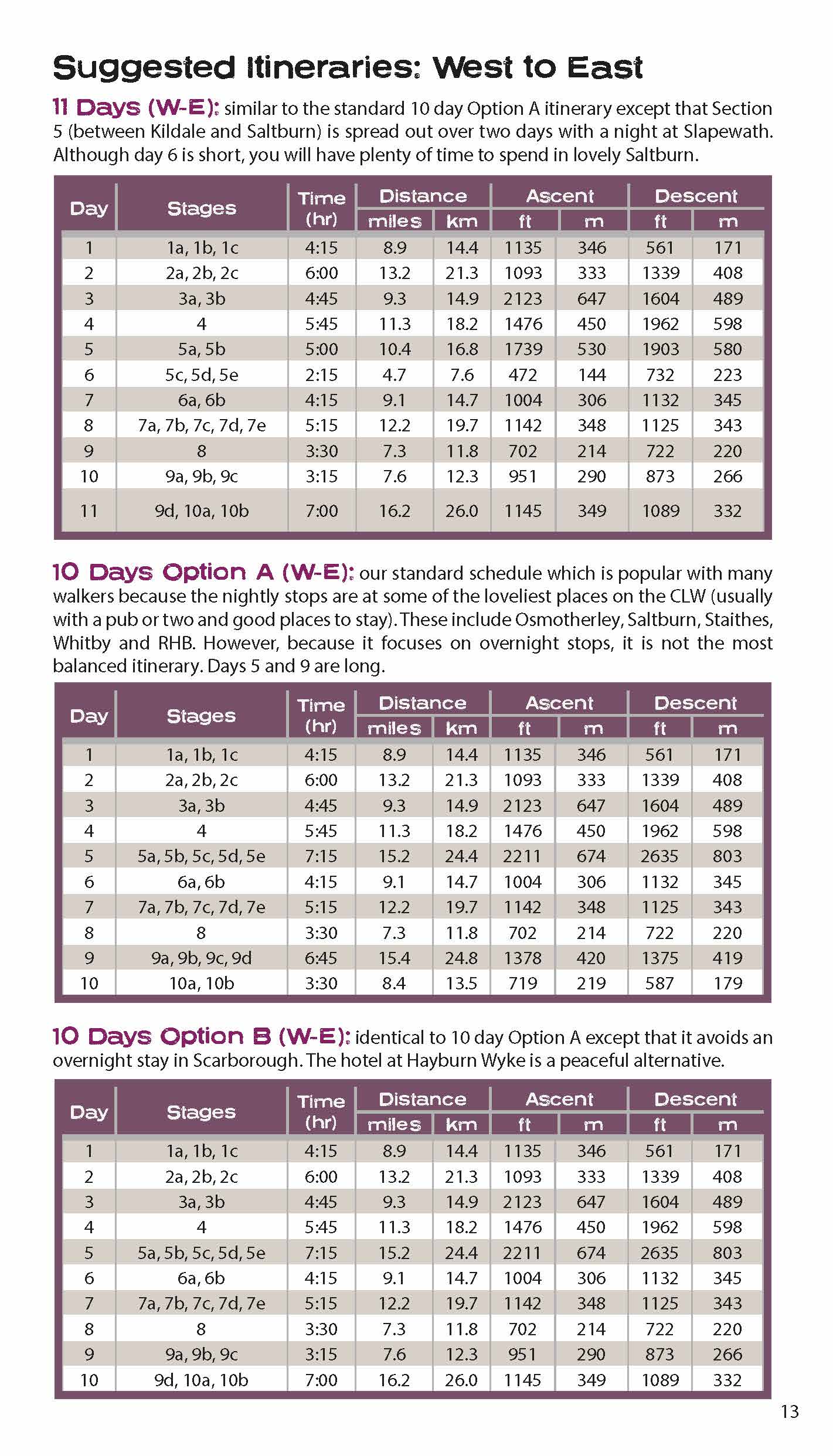
20 different itineraries: schedules of 5, 6, 7, 8, 9, 10 and 11 days for hikers and runners. Includes both eastbound and westbound itineraries. Difficult calculations of time, distance and altitude gain/loss are done for you.
Also includes:
- Detailed information on equipment and travelling lightFull accommodation listings: the best pubs, B&Bs and hotels
- Detailed section on camping, including wild camping
- Everything the trekker needs to know: route, costs, difficulty, weather, travel, and more
- Essential info for both self-guided and guided trekkers
- Information on plants and wildlife
- Numbered waypoints linking the Real Maps to our clear descriptions
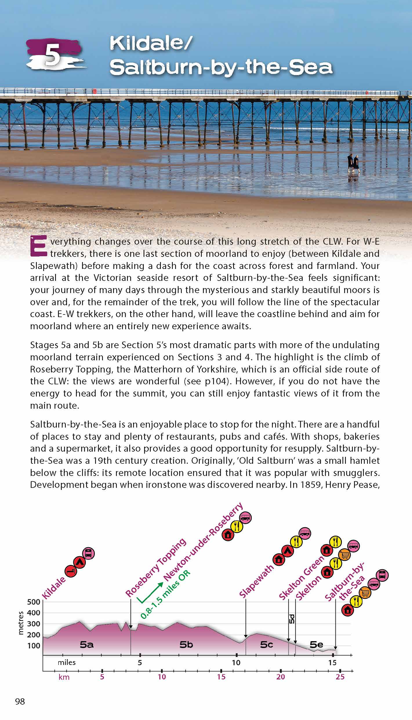
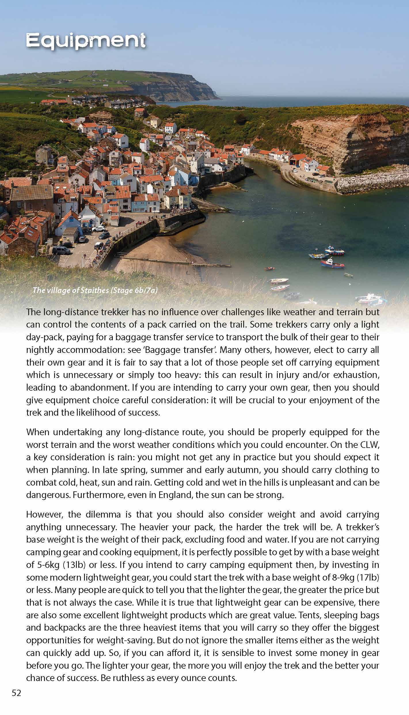
The route circumnavigates the spectacular North York Moors National Park. It explores both the evocative expanses of Yorkshire's famous heather moorland and the never-ending cliffs of its coastline. This is England at its best and it will be an adventure that you will never forget
Trekking the Hadrian’s Wall Path (2024 Updated Version)
Available now!
Real OS maps 1:25,000
The definitive two-way guide to the Hadrian’s Wall Path: both eastbound and westbound routes are described in full.
14 different itineraries: schedules of 3, 4, 5, 6, 7, 8 and 9 days for walkers and runners. Includes both northbound and southbound itineraries. Difficult calculations of time, distance and altitude gain are done for you.
Also includes:
- Extraordinary detail on the history and construction of Hadrian’s Wall
- Section on the unmissable forts of Hadrian’s Wall
- Detailed information on equipment and travelling light
- Everything the trekker needs to know: route, costs, difficulty, weather, travel, and more
- Full accommodation listings: the best inns, B&Bs and hotels
- Information for both self-guided and guided trekkers
- Numbered waypoints linking the Real Maps to our clear descriptions
Hadrian’s Wall was one of the Romans’ most ambitious structures. When completed, it ran for 73 miles between the west and east coasts of Northern England. It crossed the crags and hills of some of Britain’s wildest and most beautiful terrain.
The Hadrian’s Wall path is one of England’s official ‘National Trails’. It leads you on an unforgettable journey of discovery along the route of the Wall. Discover the incredible surviving sections of the Wall and its forts, milecastles and turrets.
Trekking the South Downs Way
The definitive two-way guide to the South Downs Way: both westbound and eastbound routes are described in full.
Real Maps: Full Ordnance Survey Explorer mapping inside (1:25,000)
18 different itineraries: schedules of 4, 5, 6, 7, 8, 9, 10, 11 and 12 days for walkers and runners. Includes both westbound and eastbound itineraries. Difficult calculations of time, distance and altitude gain are done for you.
Also includes:
- Detailed information on equipment and travelling light
- Everything the trekker needs to know: route, costs, difficulty, weather, travel, and more
- Full accommodation listings: the best inns, B&Bs and hotels
- Detailed section on camping
- Essential info for both self-guided and guided trekkers
- Information on geology, history, plants and wildlife
- Numbered waypoints linking the Real Maps to our clear descriptions
The South Downs Way leads you on an unforgettable journey of discovery through the magnificent chalk hills of Sussex and Hampshire. It travels the length of the South Downs National Park across wonderful hills and meadows bedecked with wild-flowers, through endless fields of shimmering golden corn and along the edge of the epic white cliffs of the Seven Sisters and Beachy Head. It is one of England’s official ‘National Trails’ and is an unforgettable experience
Trekking the Cotswold Way
Available Now!
The definitive two-way guide to the Cotswold Way: both southbound and northbound routes are described in full.
Real Maps: Full Ordnance Survey mapping inside (1:25,000). All accommodation is numbered and marked on the maps.
18 different itineraries: schedules of 4, 5, 6, 7, 8, 9, 10, 11 and 12 days for hikers and runners. Includes both southbound and northbound itineraries. Difficult calculations of time, distance and altitude gain/loss are done for you.
Also includes:
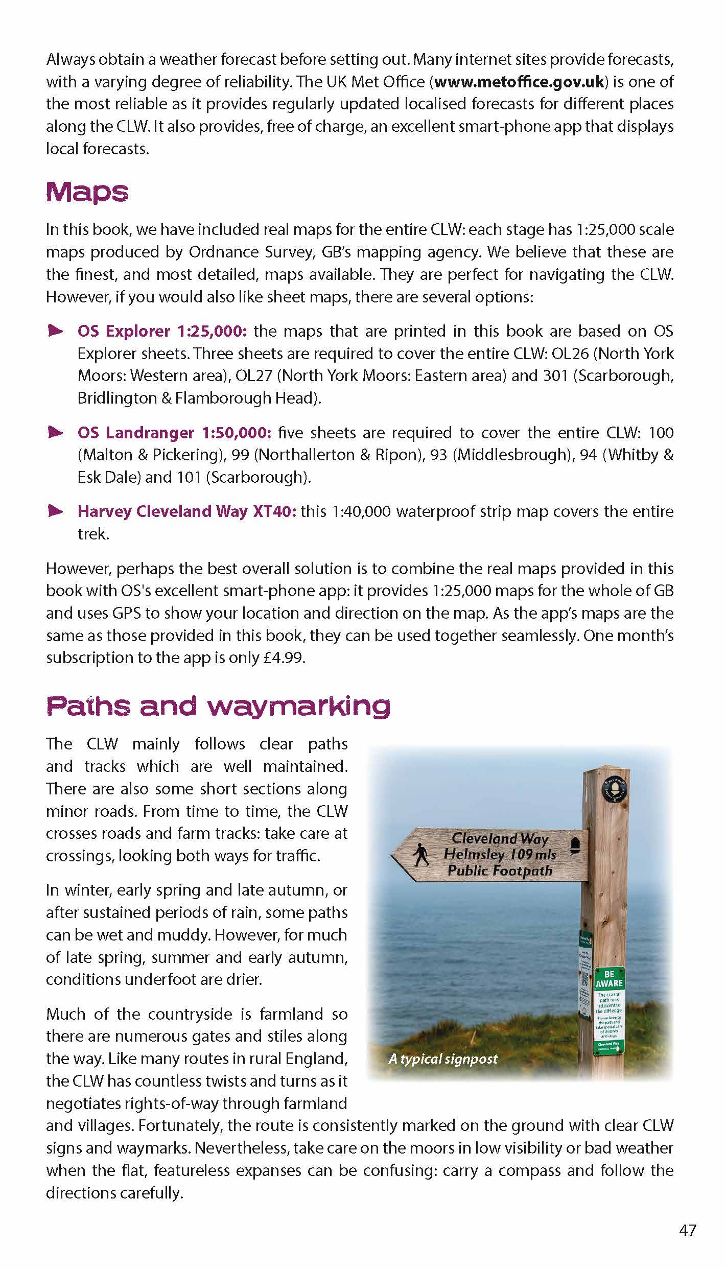
- Detailed information on equipment and travelling light
- Everything the trekker needs to know: route, costs, difficulty, weather, travel, and more
- Full accommodation listings: the best inns, B&Bs and hotels
- Detailed section on camping
- What to see in the City of Bath
- Essential info for both self-guided and guided trekkers
- Information on history, plants and wildlife
- Numbered waypoints linking the Real Maps to our clear descriptions
Trekking the Coast to Coast Path
Available Now!
The definitive two-way guide to the Coast to Coast Path: both eastbound and westbound routes are described in full.
Real Maps: Full Ordnance Survey mapping inside (1:25,000). All accommodation is numbered and marked on the maps.
19 different itineraries: schedules of 11, 12, 13, 14, 15, 16, 17, 18 and 19 days for hikers and runners. Includes both eastbound and westbound itineraries. Difficult calculations of time, distance and altitude gain/loss are done for you.
Also includes:
- Detailed information on equipment and travelling light
- Full accommodation listings: the best pubs, B&Bs and hotels
- Detailed section on camping, including wild camping
- Everything the trekker needs to know: route, costs, difficulty, weather, travel, and more
- Essential info for both self-guided and guided trekkers
- Information on plants and wildlife
- Numbered waypoints linking the Real Maps to our clear descriptions
Trekking the Cleveland Way: Two-way guidebook with OS 1:25k maps: 20 different itineraries
Available Now!
The definitive two-way guide to the Cleveland Way, one of England’s epic National Trails: both eastbound and westbound routes are described in full.
Real Maps: Full Ordnance Survey mapping inside (1:25,000). All accommodation is numbered and marked on the maps.
20 different itineraries: schedules of 5, 6, 7, 8, 9, 10 and 11 days for hikers and runners. Includes both eastbound and westbound itineraries. Difficult calculations of time, distance and altitude gain/loss are done for you.
Also includes:
- Detailed information on equipment and travelling lightFull accommodation listings: the best pubs, B&Bs and hotels
- Detailed section on camping, including wild camping
- Everything the trekker needs to know: route, costs, difficulty, weather, travel, and more
- Essential info for both self-guided and guided trekkers
- Information on plants and wildlife
- Numbered waypoints linking the Real Maps to our clear descriptions
Trekking the West Highland Way: Two-way guide
Available Now!
The definitive two-way guide to the West Highland Way: both northbound and southbound routes are described in full.
Real Maps: Full Ordnance Survey Explorer mapping inside (1:25,000)
17 different itineraries: schedules of 3, 4, 5, 6, 7, 8, 9, 10 and 11 days for hikers and runners. Includes both southbound and northbound itineraries. Difficult calculations of time, distance and altitude gain are done for you.
Also includes:
- Detailed information on equipment and travelling light
- Everything the trekker needs to know: route, costs, difficulty, weather, travel, and more
- Full accommodation listings: the best inns, B&Bs and hotels
- Detailed section on camping
- Essential info for both self-guided and guided trekkers
- Information on geology, history, plants and wildlife
- Numbered waypoints linking the Real Maps to our clear descriptions
